A nice summer week ahead
Go Deeper.
Create an account or log in to save stories.
Like this?
Thanks for liking this story! We have added it to a list of your favorite stories.
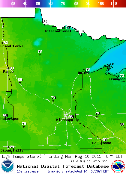
Temperatures will be ideal for outdoor activities as we move through the work week. It will feel warm in the afternoon sunshine. I'll admit that I am partial to warm temperatures in August!

High temperatures are expected to top out just a tad shy of seasonal normals.

If you missed out on the scattered thunderstorms on the weekend, it looks like Wednesday night is the best opportunity to get caught up on precipitation in your back yard.
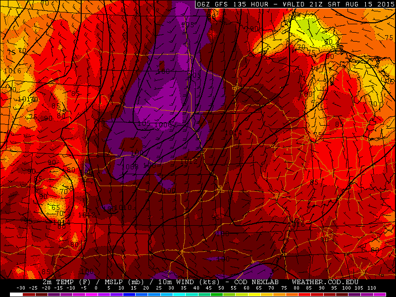
The National Oceanic and Atmospheric Administration's Global Forecast System model is trying to push hot air over the northern Plains and into western Minnesota on Saturday. Here's a look at the surface pressure pattern, wind and temperatures for 4 p.m. this Saturday.
Turn Up Your Support
MPR News helps you turn down the noise and build shared understanding. Turn up your support for this public resource and keep trusted journalism accessible to all.

One of the challenges with interpreting radar images in the early morning hours, when a temperature inversion sets up, is the expansive ground clutter that is displayed on the local radar.
This morning's image shows the wide coverage of false echoes. Here's the radar display from 6:30 a.m. Is it raining at your place?

By examining the satellite image and surface reports a meteorologist can determine if any of these returns are truly precipitation echoes.
This infrared satellite image from 5:30 a.m. nicely depicts the thunderstorms resulting in flash flood warnings in southern Missouri, but not much in the way of cloud cover over Minnesota.

Thunderstorms rumbled across north central and northeast Minnesota on Saturday afternoon and evening. Some flooding was reported in Ely, Minn., with hail up to 1.75 inches in diameter reported in Kettle River, Minn.
The Duluth National Weather Service collected the storm reports from the scattered thunderstorms on Saturday.
Here's a look at the region of the state that was doused on Saturday. Aitkin, Minn., reported 2.12 inches of rain.

More thunderstorms moved west to east across the southern half of the state on Sunday. Radar estimates suggest more than 2 inches accumulated in a band across Minnesota from about Elk River, Big Lake and Annandale to near Litchfield and Atwater to the north and west of the Twin Cities.
As the thunderstorms drifted east the intensity decreased and Holman Field in St. Paul tallied only 0.05 inch of precipitation.
Rain has been sparse in parts of southeast Minnesota so far this month. Less than a tenth of an inch of rain has accumulated in Rochester, Minn., in the month of August.


