Fog dissipates; rather muggy conditions remain
Go Deeper.
Create an account or log in to save stories.
Like this?
Thanks for liking this story! We have added it to a list of your favorite stories.
A stubborn stratus cloud layer persisted over parts of east central Minnesota on Wednesday before giving way to late afternoon sunshine. The clouds held the temperatures in the 70s from the Twin Cities to St. Cloud.
[image]
Mostly sunny skies allowed the mercury to soar to 90 degrees at Fargo, N.D., and Moorhead, Minn., Wednesday afternoon.
Once again this morning we are dealing with areas of fog and low clouds as a result of high levels of water vapor and relatively light winds.
Turn Up Your Support
MPR News helps you turn down the noise and build shared understanding. Turn up your support for this public resource and keep trusted journalism accessible to all.
Note the returns of the milky white color over southern Minnesota on this enhanced water vapor satellite image indicating some extent of the water vapor in the vertical profile of the atmosphere.

We are expecting the fog and stratus clouds to thin out this morning resulting in a very warm and humid afternoon.

By late afternoon the heat index values should be close to 90 degrees across western and southern Minnesota. More comfortable conditions are in store for the Arrowhead as well as along the shoreline of Lake Superior.

In case you missed it, yesterday brought a rather prolonged period of heavy rain in west central Wisconsin. Isolated locations between Rice Lake and Eau Claire were flooded with more than 4 inches of rainfall.
Warm and humid conditions are expected to continue through the weekend. This forecast graphic is from the National Weather Service in Chanhassen and shows the summer-like conditions in the Twin Cities metro through Sunday.

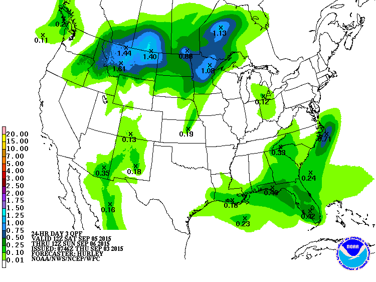
As a cool front approaches on Saturday night chances for strong thunderstorms will be on the rise. We'll track the timing of showers and their intensity as we move through the weekend.

The longer range outlook from the National Oceanic and Atmospheric Administration's Climate Prediction Center is for temperatures to trend below normal as we go into the middle of September.


