Spring weather perfection Tuesday, rain and thunder Wednesday

Go Deeper.
Create an account or log in to save stories.
Like this?
Thanks for liking this story! We have added it to a list of your favorite stories.
I smelled spring last night.
It was in the air on my late evening walk. The southeast breeze felt different. A touch of humidity graced the air.
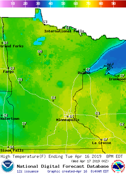
Tuesday's bright sun and milder temperatures remind us that April is springtime in Minnesota. Highs reach the 60s across a good chunk of our state this afternoon.

Rainy Wednesday
Turn Up Your Support
MPR News helps you turn down the noise and build shared understanding. Turn up your support for this public resource and keep trusted journalism accessible to all.
A fast-moving low-pressure storm zips our way Wednesday. Rain blossoms across southern Minnesota by the morning rush hours. Scattered thunderstorm pop during the midday and afternoon hours. A few of those will be feisty with local downpours, even small hail.
The National Oceanic and Atmospheric Administration's NAM 3 km resolution model has the capability to paint individual convective clusters Wednesday.

Overall rainfall totals between one-half and 1 inch will cover much of Minnesota. Some localized 1 inch-plus totals favor southern Minnesota.

Milder days ahead
The overall pattern looks milder. Several models suggest highs will reach 70 degrees Saturday across most of western Minnesota, possibly into the Twin Cities.

Snowiest winter on record in Eau Claire, Wis.
This is one time I'm OK with 11th place for the Twin Cities.


