September summer: heat and more storms this week
Highs reached 90 degrees Tuesday
Go Deeper.
Create an account or log in to save stories.
Like this?
Thanks for liking this story! We have added it to a list of your favorite stories.
Summer weather is pushing well into September this year.
Minnesota rides the northern part of a July-like air mass. Temperatures hit 90 degrees in several Minnesota towns today. I saw 91 in Cambridge, Litchfield and Canby Tuesday afternoon.

The upper air pattern over North America continues to show the main polar front jet stream displaced well north into Canada. There are signs our unseasonably warm pattern could persist into the first days of October.

A weak cool front slides south across Minnesota Wednesday. But the air mass behind the front is still several degrees warmer than average for mid-September. Highs in the 70s and 80s persist in the Twin Cities and southern Minnesota for the next week. Shave a few degrees off up north.
Turn Up Your Support
MPR News helps you turn down the noise and build shared understanding. Turn up your support for this public resource and keep trusted journalism accessible to all.

Overnight thunder
Strong storms rolled through Ely, Minn., and the the Boundary Waters Canoe Area Tuesday afternoon.
A weak cool front triggers a line of storms in western Minnesota around midnight. Most forecast models bring a broken line of thundershowers into the Twin Cities and eastern Minnesota between 5 and 7 a.m. give or take.

There is a marginal risk a few storms could be severe as the line pushes eastward overnight. The highest rainfall chances favor central Minnesota.
September monsoon
The most prominent weather and climate trend in Minnesota this year continues to be heavy rainfall. Much of Minnesota has recorded two to four times our average monthly rainfall so far.
Rochester has picked up an incredible 6.33 inches of rainfall this month. That’s two months’ worth of rain in about two weeks.
The Twin Cities is now just 7 inches shy of the all-time record for the wettest year on record set just in 2016.
With over three months left to go in 2019, I’d say there’s an 80 percent chance we will break the record from 2016 for the wettest year on record.
Soggy fields
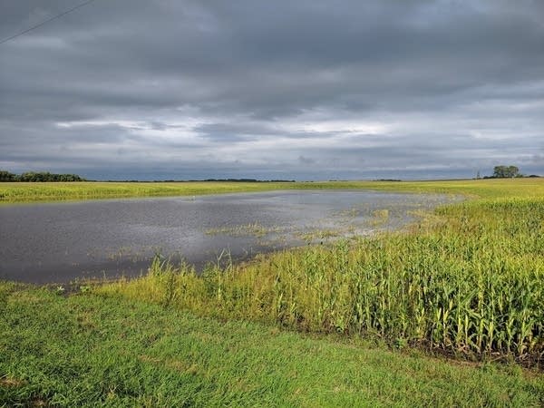
I spent some time in beautiful western Minnesota last weekend. I have never seen so much standing water in farm fields in Minnesota.

There’s a lot of corn and beans with “wet feet” this September. At this rate, farmers may have to start growing rice.

This week’s Minnesota Crop Report confirms the state of what I observed in the fields. Almost half — 42 percent — of topsoil moisture is rated as surplus. And corn development is way behind the five-year average.


