Major storm: Heavy snow spreading north, rapidly deteriorating roads
Snowfall rates of 1 inch per hour spreading north Friday afternoon

Go Deeper.
Create an account or log in to save stories.
Like this?
Thanks for liking this story! We have added it to a list of your favorite stories.
Our long-anticipated Janaury snowstorm is spreading north across Minnesota Friday afternoon. For up to the minute storm updates check out the MPR Live Severe Weather blog.
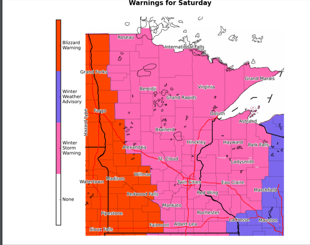
Winter storm and blizzard warnings cover a big chunk of the Upper Midwest.

Several locations in southwest Minnesota have already reported heavy snowfall rates of 1 inch per hour. Sioux Falls, South Dakota picked up over 5 inches of snow quickly Friday morning.
Road conditions in southwest Minnesota are already deteriorating.
Turn Up Your Support
MPR News helps you turn down the noise and build shared understanding. Turn up your support for this public resource and keep trusted journalism accessible to all.
Snow spreading north
Snow continues to spread north and east today. NOAA’s HRRR model captures the essence of the snow shield with embedded heavy snow bands moving northeast.

Snow begins to taper off from west to east Saturday morning. But high winds behind the system will keep blowing snow and blizzard conditions going through much of Saturday.
Snowfall totals
Most forecast models still cluster a wide area of 6 to 12 inches across Minnesota by late Saturday.

NOAA’s GFS model has been among the most aggressive and cranks out double-digit snowfall totals for the Twin Cities with up to a foot just west.

Travel will be most difficult late Friday afternoon through Saturday morning in most areas.
Stay safe out there Minnesota!


