

Red River Valley blizzard Wednesday; 36-hour Arctic blast follows
Snow could impact Twin Cities Wednesday afternoon rush hours
Go Deeper.
Create an account or log in to save stories.
Like this?
Thanks for liking this story! We have added it to a list of your favorite stories.
Get ready for some big weather changes in the next 48 hours.
An arctic front blows south through Minnesota Wednesday. The system brings light snow and gusty winds to near 50 mph in open areas. That means blowing snow and difficult travel. Bitter cold follows for about 36 hours.
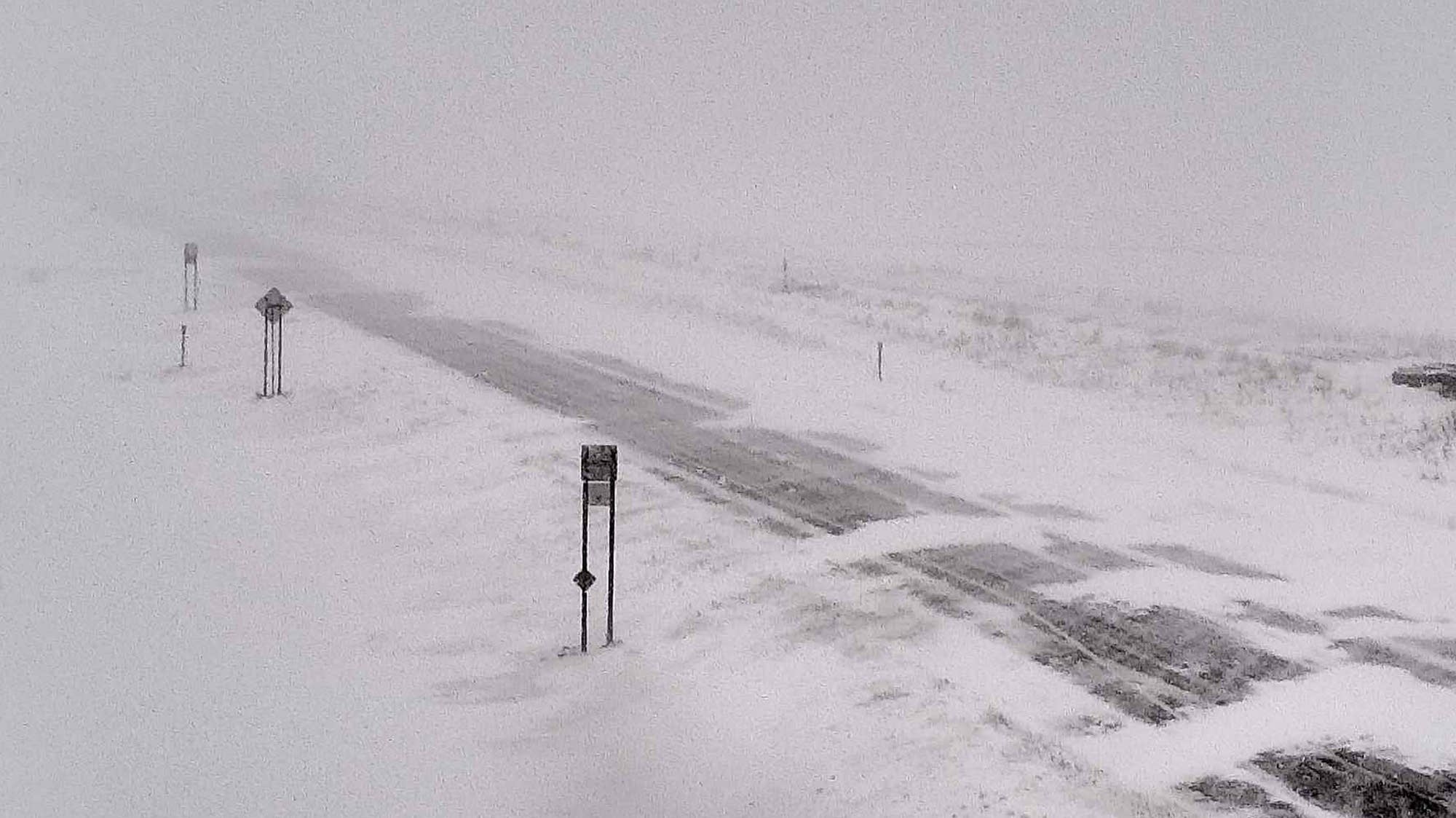
Red River Valley blizzard possible
Our inbound arctic front blows through the Red River Valley overnight into early Wednesday. It may only drop an inch or 2 of snow, but that’s enough to create ground blizzard conditions.
Here’s the latest situation report from the Grand Forks, N.D., National Weather Service office.
Turn Up Your Support
MPR News helps you turn down the noise and build shared understanding. Turn up your support for this public resource and keep trusted journalism accessible to all.
Loose snow
Our recent snow systems dumped plenty of light fluffy snow across Minnesota. There’s plenty of loose snow that will go airborne once winds exceed 40 mph.
So it’s not just falling snow that causes blowing and drifting. It’s the light fluff on the ground right now. Expect plenty of blowing snow Wednesday into Thursday.
Wednesday snow
Arctic fronts are experts at paving the way for bitterly cold air with a fresh coating of snow. NOAA’s GFS paints the snow zone moving across Minnesota Wednesday. Then watch the arctic high-pressure cell drive south into the Dakotas by Thursday morning.

For the Twin Cities, it looks like snow will begin around midday and last into afternoon rush hours.
Naturally.
Snowfall totals will be in the 1- to 2-inch range for most of Minnesota Wednesday.

36-hour arctic blast
The core of the cold crosses Minnesota between about midnight Thursday and noon Friday. Lows bottom out in the minus 20s to around minus 30 across northern Minnesota. The coldest morning for the Twin Cities looks like Friday morning when we could bottom out around minus 12.

Brief cold snap
This is a brief cold snap. Highs rebound into the 30s again by this weekend.

Mild February finish?
This winter is running about 4 degrees warmer than average so far for much of Minnesota. I’m still seeing that mild bias signal overall into late February. The upper air pattern for the next two weeks favors frequent incursions of mild Pacific air masses.

The 16-day temperature outlooks suggest we may hit 40 degrees more than once in the last two weeks of February.

After the last two years, I’m hesitant to say we'll get out of this winter without a big late-season snow event. But the odds we’ll see another huge April blizzard three years in a row are slim. My weather spidey senses tell me this just might end up being an easier spring than the past two years.
Stay tuned.