

Winter halftime report card: Unseasonably mild, high snowfall variability
It's a very mild winter so far. Will La Niña bring more cold and snow?
Go Deeper.
Create an account or log in to save stories.
Like this?
Thanks for liking this story! We have added it to a list of your favorite stories.
We've turned the corner into the second half of winter in the Upper Midwest. The first half of winter has brought some surprises to Minnesota.
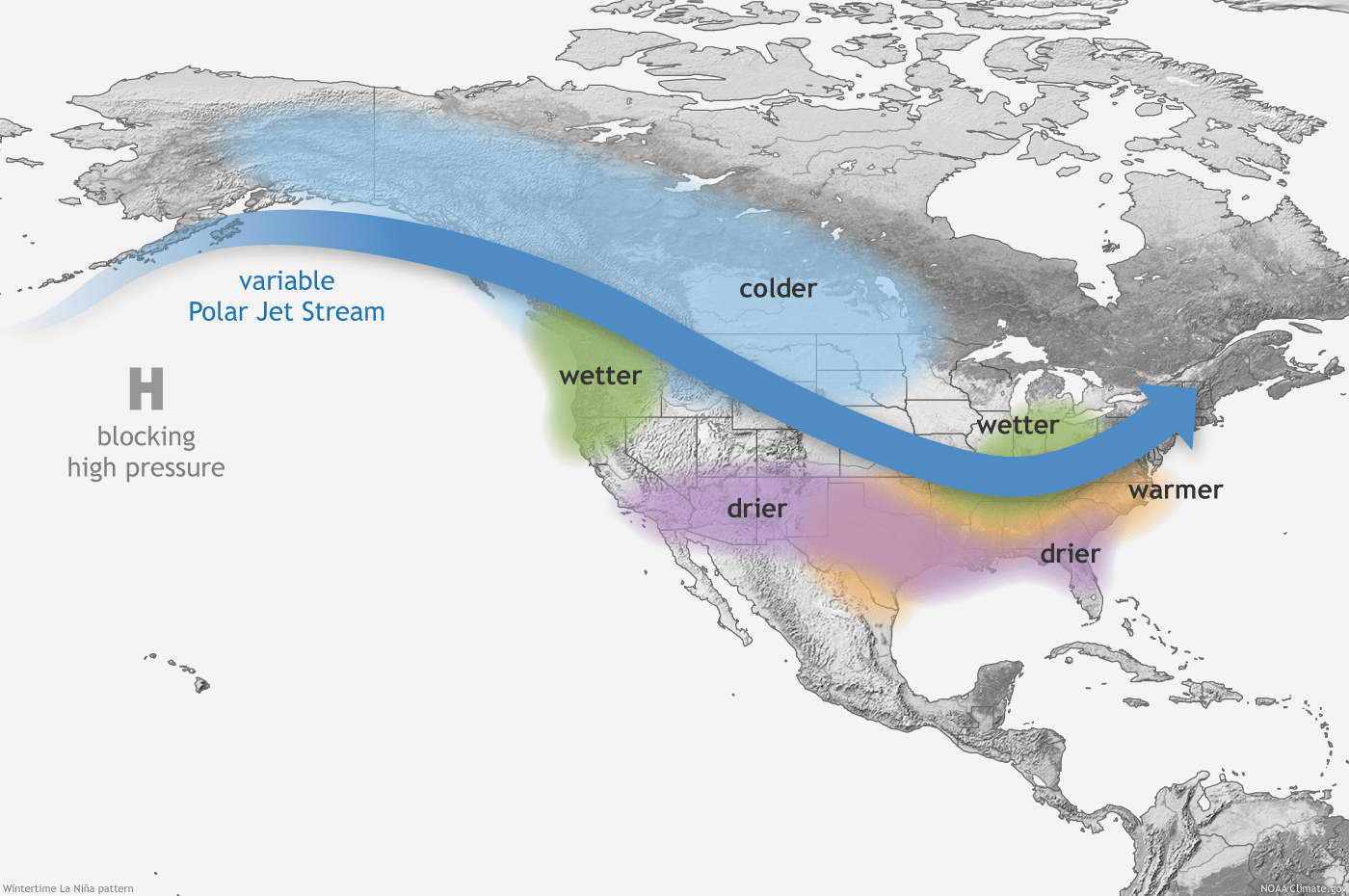
The ongoing La Niña event in the tropical Pacific Ocean strongly favors cold and snowy winters in the Upper Midwest.

But our typical La Niña winter is AWOL this year. Though some Minnesota locations have piled up near to above-average snowfall, many locations are running below average on snowfall so far. And temperatures are running well above average across all of Minnesota this winter so far.
Winter Lite
Support Local News
When breaking news happens, MPR News provides the context you need. Help us meet the significant demands of these newsgathering efforts.
Iv’e used the term winter lite more than once to describe our mild winter so far.
Temperatures in the Twin Cities are running about 7 degrees warmer than average overall since the start of meteorological winter on December 1.
It’s been even milder in western Minnesota. Temperatures over the past 30 days are running more than 10 degrees warmer than average in the Red River Valley and northwest Minnesota.

Variable snowfall distribution
As for snow, there is significant spatial variability in snowfall this season. The Twin Cities and Duluth are running slightly above average snowfall this winter. But Rochester, International Falls, and Fargo-Moorhead/Red River Valley are running snowfall deficits.
Here’s a look at seasonal snowfall vs. average for some select locations.
Location/snowfall/snowfall vs. average
Twin Cities 33.4” (+4.8”)
Duluth 49.7” (+4.5”)
St. Cloud 23.9 (+0.3”)
Rochester 17.4” (-8.2”)
International Falls 27.0” (-12.9”)
Fargo/Moorhead 16.7” (-9.7”)
The past 30 days have delivered slightly above average snowfall in a swath from the Twin Cities through Mille Macs, Brainerd, toward Bemidji. But notice the snowfall deficits in western, southeast, and northeast Minnesota.

2nd half winter outlook
The La Niña event in the Pacific is ongoing. Theoretically, that should favor a colder, snowier second half of winter.
The next 1-2 weeks do look colder overall across the Upper Midwest. A colder air mass late this week should drop temperatures to near and (slightly) below zero across Minnesota by Saturday morning.
NOAA’s 6 to 10-day outlook currently favors colder than average temperatures in our region.

But some models are already suggesting a return to highs in the 30s for the last days of January.
As for snowfall, it’s a random guess as to which parts of Minnesota will get snow with each passing system. One thing we know for sure. It can snow in Minnesota in February and March.
And April.