Severe storm risk Thursday for much of Minnesota
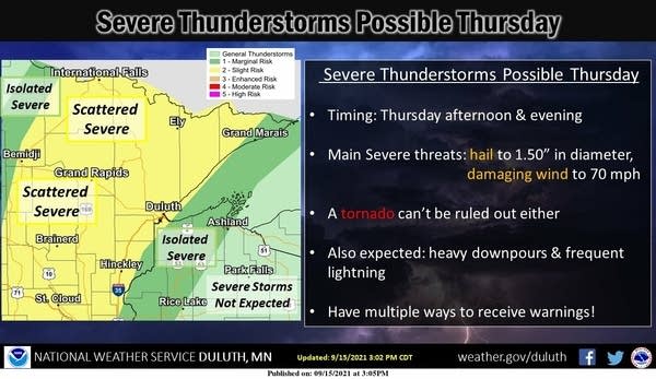
Scattered strong to severe storm chances favor northern and central Minnesota Thursday. It's a lower risk for the Twin Cities area Thursday night.

Go Deeper.
Create an account or log in to save stories.
Like this?
Thanks for liking this story! We have added it to a list of your favorite stories.
I hope you’re enjoying our fine September weather again today.
Minnesota is riding the northern part of a balmy September air mass. Highs in the 70s cover most of Minnesota Wednesday afternoon. Dew points in the 40s provide a superior comfort level. This air mass is more like Arizona. In late November.
Severe risk Thursday
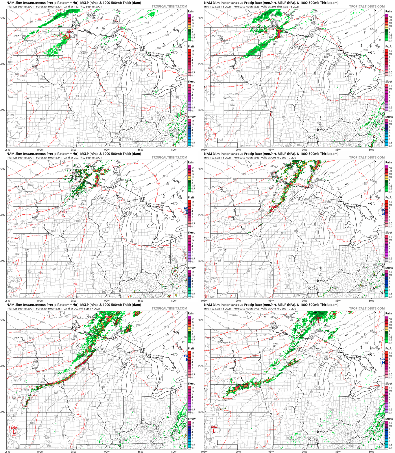
Our dew points will increase into the 60s tomorrow with the southerly flow. A cold front slides into Minnesota tomorrow. As it cuts into our warmer, more unstable air mass expect scattered thunderstorms to blossom across northern Minnesota Thursday afternoon. The air mass will be most unstable up north, but the line may form a southerly extension into central Minnesota and possibly the Twin Cites by Thursday evening.

NOAA’s NAM 3 km resolution model picks up on that notion and brings a cluster of rain and thunder near the Twin Cities by 9 to 10 p.m. Thursday evening.
Turn Up Your Support
MPR News helps you turn down the noise and build shared understanding. Turn up your support for this public resource and keep trusted journalism accessible to all.

NOAA’s Storm Prediction Center paints a slight risk through northern Minnesota extending south through central Minnesota and into the northwest Twin Cities, with a lesser marginal risk for the rest of the Twin Cities area.

Keep an eye out for possible strong to severe storms. Especially in northern and central Minnesota Thursday. The Twin Cities may see storms that are fading a bit as they approach after dark Thursday night.
Rainfall potential
Rainfall totals into Friday look variable again locally. Areas that get under more vigorous storms should pick up .50” of rain. There may be some local 1”+ totals. Here’s the European model rainfall output into Friday.

Stay tuned.


