Occasional rain into Thursday; nice start to the weekend
Sun returns Friday and this weekend; Saturday the nicer day

Go Deeper.
Create an account or log in to save stories.
Like this?
Thanks for liking this story! We have added it to a list of your favorite stories.
Our midweek weather system is taking its sweet time crawling through Minnesota Wednesday.
The GOES-16 infrared satellite loop above shows the system’s moisture plume feeding moisture almost directly north into the Upper Midwest. Note how the overall system is making very slow eastward progress.
That means scattered rain bands will shift slowly east as they move northward. Expect rain bands to linger in Minnesota into Thursday before the system finally pushes to the east by Friday.
NOAA’s NAM 3 km resolution model shows the rain band edging slowly eastward into Thursday morning. The loop below runs between 4 p.m. Wednesday and 7 a.m. Thursday.
Turn Up Your Support
MPR News helps you turn down the noise and build shared understanding. Turn up your support for this public resource and keep trusted journalism accessible to all.

Soaking rains
Most of Minnesota will get rain with this system. The most soaking rainfall over an inch favors central Minnesota. The Twin Cities looks likely to end up with between about .50 inch and 1 inch rainfall.

Sun returns Friday
Assuming the system doesn’t stall and moves east as expected, sunshine will return to Minnesota from west to east Friday. Clouds may linger in southeast Minnesota Friday.
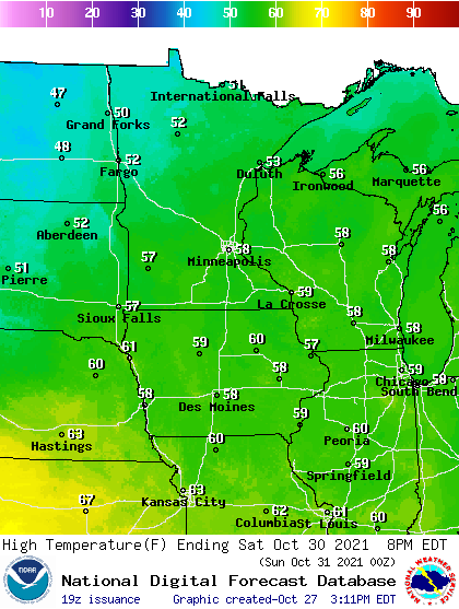
Saturday looks bright and sunny, and relatively mild. Highs will approach 60 degrees Saturday afternoon in southern Minnesota and possibly the Twin Cities.

Chilly Halloween
The Halloween forecast looks dry but cold this year. Highs will be in the 40s, and trick-or-treat temps will be in the 30s in northern Minnesota with lower 40s around southern Minnesota.

Throw in a chilly northwest breeze and costumes with fleece underneath will be prized Halloween night.


