Impressive Tuesday snowfall totals; even heavier snow event possible Friday
Several inches looks increasingly likely for southern Minnesota Friday

Go Deeper.
Create an account or log in to save stories.
Like this?
Thanks for liking this story! We have added it to a list of your favorite stories.
Tuesday’s light snowfall event in the central and northern Twin Cities turned into a moderate snow blast in the southern Twin Cities and southern Minnesota.

Much of the Twin Cities picked up around an inch of snow Tuesday as expected. But the system flared up to produce bands of moderate to heavy snow in the southern Twin Cities and southern Minnesota.
Here are some updated snowfall totals as the system winds down late Tuesday.
Falcon Heights 1.2 inches
Eden Prairie, Victoria 2.5 inches
Olivia 2.8 inches
Burnsville, Waseca, Rochester 3 inches
Apple Valley, Winthrop 3.5 inches
Henderson 5.3 inches
Northfield 6 inches
Minnesota’s weather looks quieter Wednesday. A chance for more light snow is possible Thursday. Temperatures will moderate through the 20s and 30s with some highs in the low 40s in southwest Minnesota Thursday.
Turn Up Your Support
MPR News helps you turn down the noise and build shared understanding. Turn up your support for this public resource and keep trusted journalism accessible to all.

Significant snow Friday?
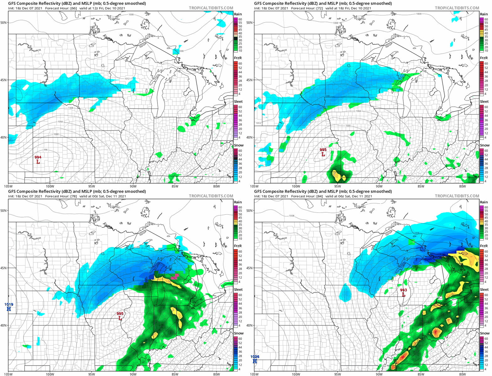
Forecast models are cranking up another significant low-pressure system Friday. Current storm tracks favor the heaviest snow bands across southern Minnesota. But these tracks will likely change a bit, and a shift of just 40 miles or so can make the difference between heavy snow band setting up over the Twin Cities, or across southern Minnesota.
Here’s NOAA’s GFS 18Z run Tuesday afternoon. It would suggest the heaviest snow bands across southern Minnesota south of the Twin Cities. The future radar forecast loop below runs between 6 am Friday and midnight Friday night/Saturday.

As we say in the weather biz, Friday looks “interesting.”
Stay tuned.


