Brutal cold eases Friday afternoon, then comes snow

Go Deeper.
Create an account or log in to save stories.
Like this?
Thanks for liking this story! We have added it to a list of your favorite stories.
By late Friday afternoon, most of the state should see temperatures in the teens, with some 20-degree readings in western Minnesota. Three clipper systems begin to sweep in Friday, bringing stretches of snow through Monday.
Bitter cold recedes
While not quite a big warm up, we get a break from the bitter cold at least. If you were hoping for a repeat of Tuesday’s 42 degrees, I must disappoint.
We’re not quite seeing warm air stream in, but rather the core of the cold move out of the area, allowing a modification of temperatures across the state, for now.

Minnesota, however, will see highs in the teens later Friday and through the weekend into Monday. Readings in western and northwestern Minnesota are already 20 to 30 degrees warmer than just 24 hours ago as temps went up through the night in those areas.
Turn Up Your Support
MPR News helps you turn down the noise and build shared understanding. Turn up your support for this public resource and keep trusted journalism accessible to all.

With the coldest of air moving just off to our north and east, this allows the jet stream to move overhead again. This will bring three separate systems through the region at rapid speed as the winds aloft (30,000 feet) will be up to 100 mph or more at times.
Generally these clipper systems will bring light snowfall, but the third one on Monday will have more moisture and linger a little longer.

The timing of these systems will each be mainly evening and overnight. The first arrives early afternoon Friday in western Minnesota, and about 6 p.m. in the Twin Cities. Expect several hours of light snow, ending by midnight.
The second comes Saturday evening and the third later in the night Sunday night, lingering into early Monday morning.

Friday night and Saturday night’s snowfalls will be relatively light with amounts around 1 inch in the Twin Cities area, though northern Minnesota could see a few spots of 2 and 3 inches.


Behind Monday’s snowfall, which could yield more than 2 inches and mess up the Monday morning commute, we’ll see another blast of arctic air for Tuesday and Wednesday. We could even see temperatures back to around minus 10 in the early morning Tuesday or Wednesday.

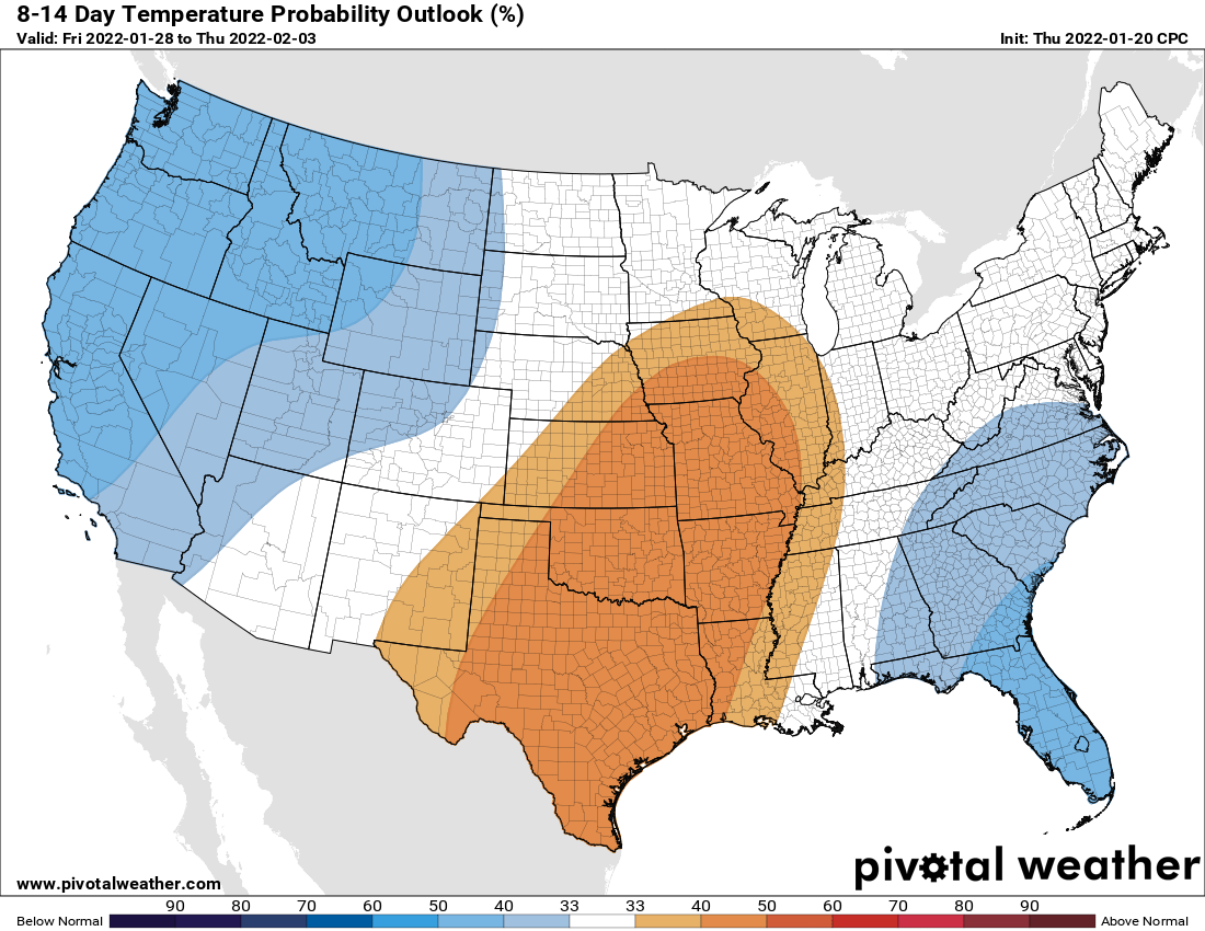
After that there are signs of a significant warmup. The climate prediction center is forecasting odds of normal or above-normal temperatures in the 8 to 14 day outlook.

Hold on folks!


