2-part storm brings rain, ice and snow to Minnesota into Thursday morning
Twin Cities starts with rain, a couple inches of slush possible Wednesday night

Go Deeper.
Create an account or log in to save stories.
Like this?
Thanks for liking this story! We have added it to a list of your favorite stories.
Updated: 5:20 p.m.
Here’s a Tuesday evening update on short-term weather conditions through early Wednesday morning.
A mix of rain, sleet, freezing rain and snow is progressing across Minnesota through Wednesday morning. NOAA’s HRRR model shows waves of mostly rain with some sleet potentially mixed in around the greater Twin Cities.

Expect waves of mostly sleet and freezing rain to increase in central Minnesota overnight, transitioning to areas of snow in northern Minnesota. See the image at the top of this post for expected weather conditions at 5 a.m. Wednesday.
The overall storm outlook looks very similar to my post from earlier Tuesday afternoon below.
Turn Up Your Support
MPR News helps you turn down the noise and build shared understanding. Turn up your support for this public resource and keep trusted journalism accessible to all.
Below is my previous post from 2:30 p.m. Tuesday.
We’re getting a little more clarity on our sloppy inbound storm system this week. A little more.
This one is essentially a two-part weather system that will bring moisture to most of Minnesota. Let’s break down the scenario for what we can expect through Thursday with our next weather system.
Part 1: Tuesday night and Wednesday
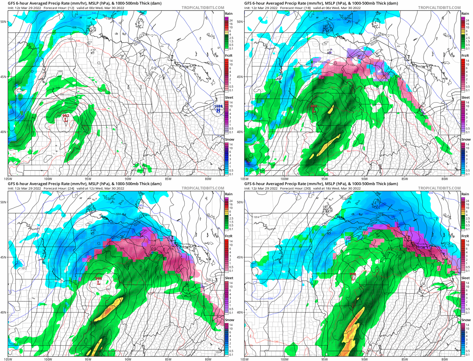
A low-pressure system crosses Iowa later Tuesday night and Wednesday. Look for a mix of rain, ice and snow to spread across Minnesota tonight through Wednesday.
I like the general look of the thermal profile with NOAA’s GFS model for locations of rain, (Twin Cities) ice, (central Minnesota into Wisconsin) and snow (western through northern Minnesota) tonight through midday Wednesday.

This first wave brings ice to mostly snow across central to northeast Minnesota. A winter weather advisory is out for northeast Minnesota into Wednesday afternoon.

For the Twin Cities and southern Minnesota, phase one of this system will bring mostly rain.
Part 2: Wednesday night into early Thursday
The second phase of this system brings a wave of upper air energy across the Midwest. This will occur on the backside of the low-pressure passage as subfreezing air blows in. That means a change to mostly snow for the Twin Cities and southern Minnesota into Wisconsin Wednesday night into early Thursday.
NOAA’s NAM 3 km resolution model is among those that show a band of snow developing along the backside of the system Wednesday evening into early Thursday from the Twin Cities eastward. The loop below runs between 6 p.m. Wednesday and 3 a.m. Thursday.

The forecast models are a patchwork of highly localized snowfall totals across southern Minnesota by Thursday morning. NOAA’s general idea of anywhere between a track to 2 or 3 slushy inches by Thursday morning seems probably for most of the Twin Cities and southeast Minnesota.

An inch of liquid
The most important feature of this system is that we’ll pick up another inch of moisture for much of Minnesota.

Milder by Sunday
Looking for some good news by the weekend? Forecast models suggest we should see more 50s, and even 60s across southern Minnesota by Sunday afternoon.

So any snow that falls in southern Minnesota won’t stick around long.


