

Second wave of severe storms possible Monday afternoon
Hail, damaging wind and even a tornado possible
Go Deeper.
Create an account or log in to save stories.
Like this?
Thanks for liking this story! We have added it to a list of your favorite stories.
Heads up eastern Minnesota and western Wisconsin. A wave of strong to potentially severe thunderstorms looks likely to develop in or near the greater Twin Cities area Monday afternoon.
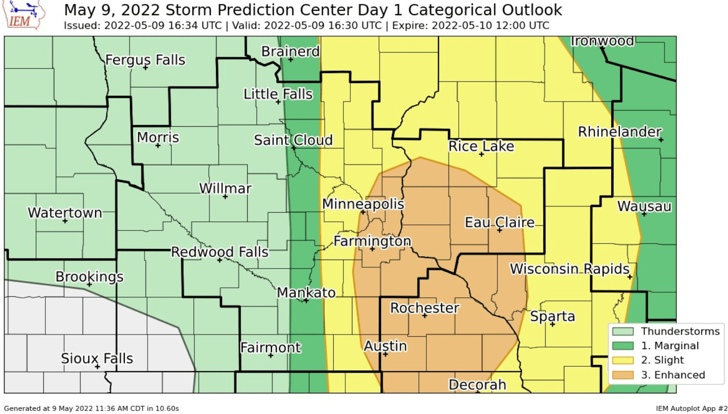
The National Oceanic and Atmospheric Administration’s Storm Prediction Center has laid out an enhanced risk for severe storms in an area that includes much of the Twin Cities, eastern Minnesota, and western Wisconsin. (see the graphic above)
A few short-range forecast models develop a cluster of storms in or near the greater Twin Cities area and into western Wisconsin between about 3 p.m. and 6 p.m.
NOAA’s Weather Research and Forecasting model is among the most aggressive. It develops storms right over the Twin Cities between about 3 p.m. and 4 p.m.; the line intensifies and moves into western Wisconsin through 10 p.m.
Turn Up Your Support
MPR News helps you turn down the noise and build shared understanding. Turn up your support for this public resource and keep trusted journalism accessible to all.

The storms could produce similar results to the cells that rolled through central Minnesota Monday morning.
A few models suggest storms may develop just east of the greater Twin Cities area into Wisconsin. Precise timing of development will be critical for storms in the Twin Cities Monday afternoon.
Large hail. damaging winds and even tornadoes are possible if the storms get going quickly enough. Stay tuned for possible severe weather watches and warnings Monday afternoon and evening.
You can see up-to-the-minute updates on the MPR News severe weather live blog.