

A string of 80s, steamy and stormy with a severe risk
90s likely Thursday. Severe storms likely Wednesday and Thursday nights.

Go Deeper.
Create an account or log in to save stories.
Like this?
Thanks for liking this story! We have added it to a list of your favorite stories.
We did it again today, Twin Cities. We hit 80 degrees once again at MSP Airport. But this time, we did it with a comfortably dry air mass. Dew points hovered in the 30s and 40s across Minnesota Tuesday.
We earn our springs and summers in Minnesota. And we really earned this one. Minnesota rode the milder northern end of a steamy air mass across the central U.S. Tuesday.

But all that heat and humidity to the south gushes northward into Minnesota Wednesday. The best way to see that is the dew point loop. It still pumps tropical dew points quickly into Minnesota Wednesday.
Support Local News
When breaking news happens, MPR News provides the context you need. Help us meet the significant demands of these newsgathering efforts.
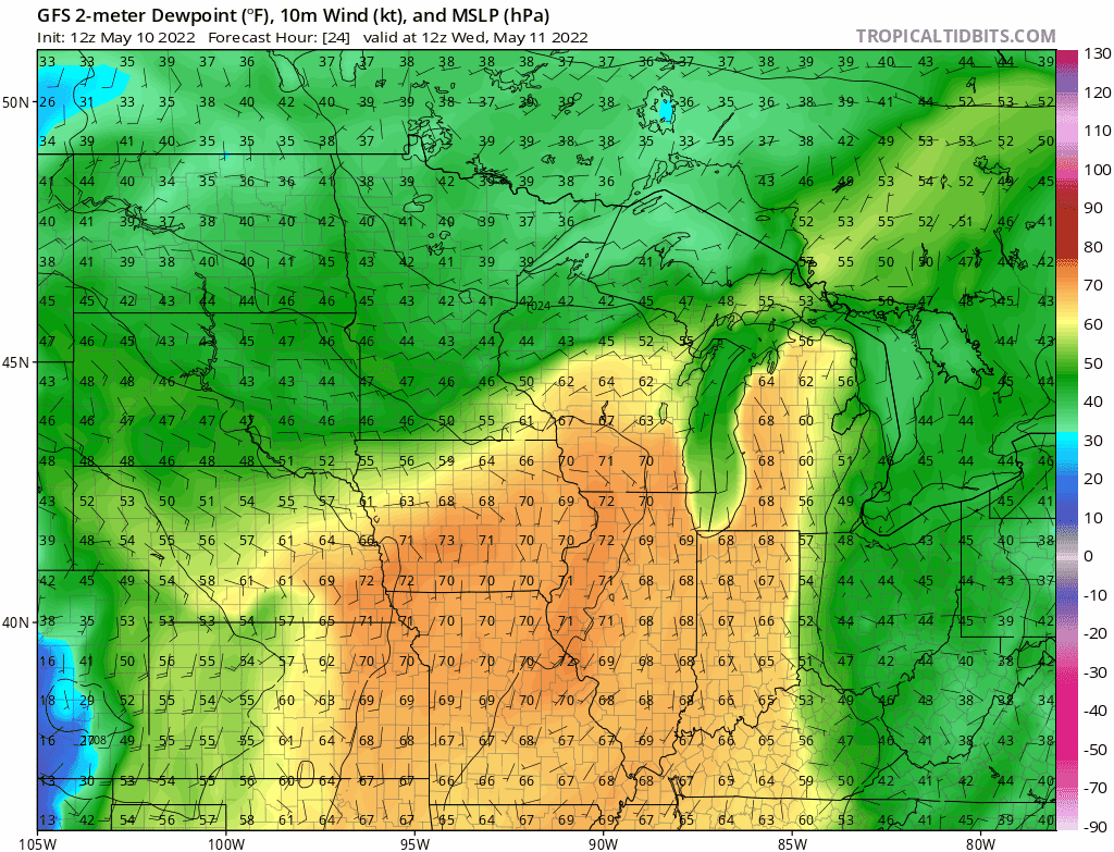
And highs will reach the 80s Wednesday, and lower 90s Thursday.

So that means we just jumped into a week that looks something like…
Monday 87 degrees
Tuesday 80 degrees
Wednesday 86 degrees
Thursday 92 degrees
Naturally.
Severe risk
Wednesday brings a slight risk for severe storms to much of Minnesota.
The timing of storms is still unclear. But a few trends are emerging. A few models suggest a slight chance for a few isolated storms moving from southwest Minnesota to near the Twin Cities around midday Wednesday.
But the better chance for more widespread storms favors Wednesday evening. NOAA’s HRRR model shows the trends, with a cluster of strong storms moving northeast through Minnesota Wednesday evening.
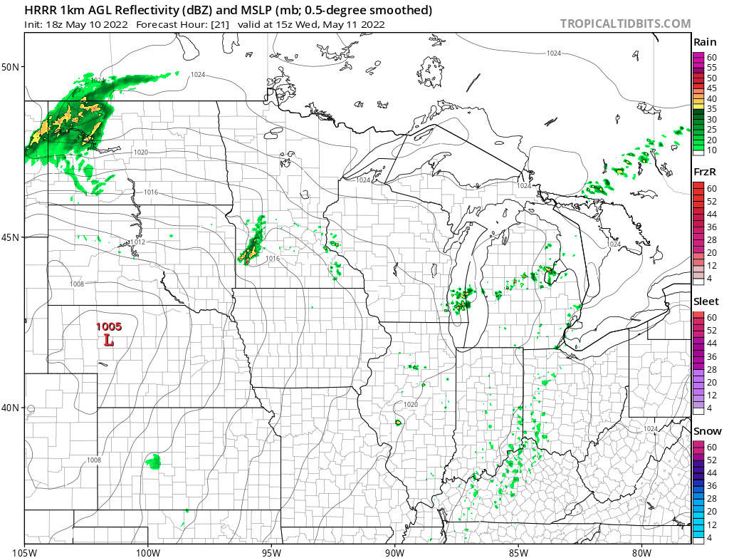
This scenario favors storms around the Twin Cities between about 10 p.m. and midnight Wednesday night into early Thursday morning.
Another shot of potentially severe storms is likely Thursday night. The timing may be later evening once again.
Stay tuned.