Hot and stormy: Pushing 90 by Thursday, severe weather threat returns
Dew points could reach the tropical 70-degree mark this week

Go Deeper.
Create an account or log in to save stories.
Like this?
Thanks for liking this story! We have added it to a list of your favorite stories.
Get ready for a taste of July, Minnesota. A steamy and stormy air mass blows into Minnesota Wednesday and Thursday. This sultry inbound air is courtesy of the Gulf of Mexico.
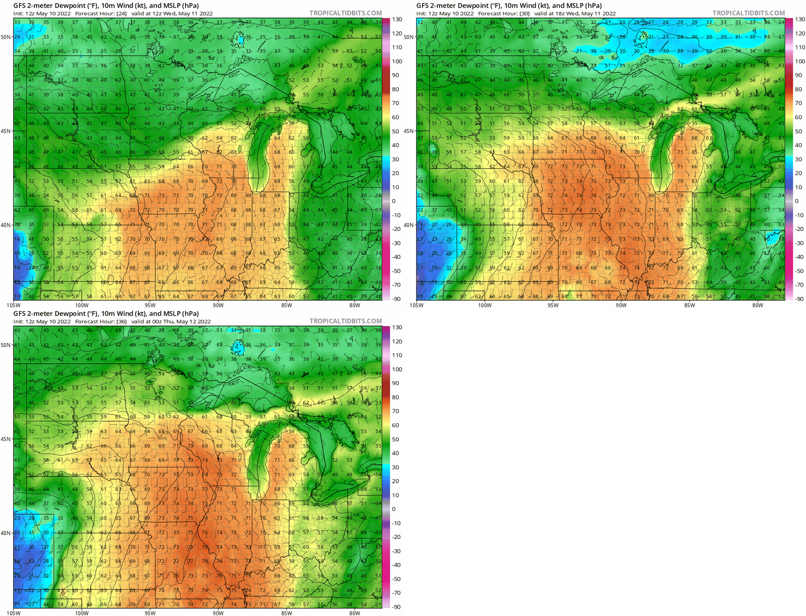
You’ll notice heat and humidity climbing rapidly by Wednesday afternoon. Dew points will start in the comfy 40s and 50s early Wednesday, then spike to near 70 degrees by later Wednesday afternoon and evening.
It will feel like you walked into a sauna Wednesday as a steamy curtain of water blows in from the south. The National Oceanic and Atmospheric Administration’s Global Forecast System model shows the rapid tropical advection process between 7 a.m. and 7 p.m. Wednesday:

First 90 Thursday?
Highs will push well into the 80s Wednesday afternoon.
Turn Up Your Support
MPR News helps you turn down the noise and build shared understanding. Turn up your support for this public resource and keep trusted journalism accessible to all.

By Thursday, the core of this hot steamy air mass should bring the first 90-degree temperatures of the year to central and southern Minnesota.

Severe risk
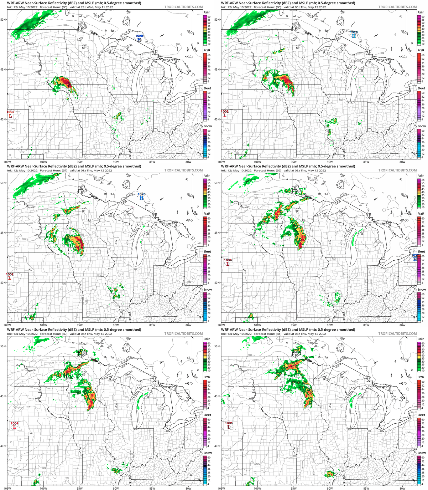
Out steamy air mass will be ripe for a couple of waves of strong to severe thunderstorms. The first wave looks likely to develop in southwestern Minnesota Wednesday afternoon and race into the Twin Cities area later Wednesday evening.
NOAA’s Weather Research and Forecasting model shows a possible bow echo signature. That suggests a line of severe storms with widespread damaging wind potential, with hail and a few tornadoes possible. The loop below runs between 6 p.m. Wednesday and midnight Thursday.

NOAA’s Storm Prediction Center paints a slight risk across much of Minnesota Wednesday.

Thursday brings another severe risk. NOAA upgrades the risk zone to enhanced Thursday.

My read on the timing of Thursday’s storms favors storms later in the evening for much of Minnesota, potentially around midnight for the Twin Cities. The timing could change.
Stay tuned and stay cool Minnesota.


