Tuesday showers favor southern Minnesota; severe risk returns Thursday
Light to moderate rain across southern Minnesota Tuesday.

Go Deeper.
Create an account or log in to save stories.
Like this?
Thanks for liking this story! We have added it to a list of your favorite stories.
I must say this past weekend was one of the best in Minnesota in recent memory.
Highs in the low 70s and dew points in the 30s and 40s with no bugs? Spectacular best in a lifetime total lunar eclipse?
Priceless.
Our lovely Monday evening gives way to a showery weather pattern Tuesday across southern Minnesota. NOAA’s NAM 3 km model shows scattered rain cell driftings across southern Minnesota in this loop between 7 a.m. Tuesday through midnight Wednesday.

Shower coverage favors southwest Minnesota Tuesday morning and midday, and southeast Minnesota including the Twin Cities from middy through Tuesday evening.
Severe risk Thursday?
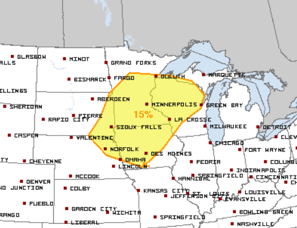
Wednesday looks quiet with temperatures peaking around 70 in the Twin Cities. A system approaching Thursday appears to bring another severe weather risk. NOAA’s Storm Prediction Center paints the potential risk zone Thursday.

Stay tuned.
Turn Up Your Support
MPR News helps you turn down the noise and build shared understanding. Turn up your support for this public resource and keep trusted journalism accessible to all.


