Thursday's severe weather risk rises; hail, high winds possible
Maps show severe weather potential Thursday especially SE of the Twin Cities

Go Deeper.
Create an account or log in to save stories.
Like this?
Thanks for liking this story! We have added it to a list of your favorite stories.
Thursday’s severe weather forecast just got a boost.
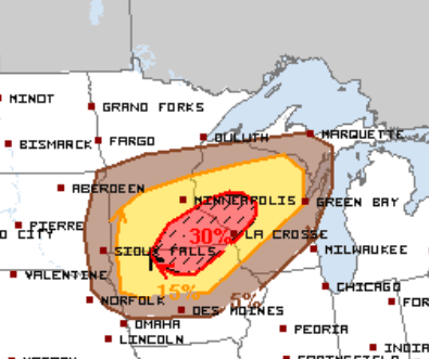
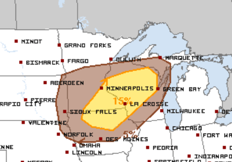
The National Oceanic and Atmospheric Administration’s Storm Prediction Center has upgraded Thursday’s severe weather risk across southeastern Minnesota to an “enhanced” level. That’s level 3 of the 5 severe weather categories NOAA uses in the daily severe weather convective outlooks.
Hail, high wind, tornado risks
Let’s break down Thursday’s severe weather threat a bit. The outlooks assign probabilities to various severe weather threats like high winds, hail and tornadoes.
Overall there’s a 30 percent chance of severe hail greater than 1 inch in diameter within 25 miles of any location across southeastern Minnesota Thursday.
Turn Up Your Support
MPR News helps you turn down the noise and build shared understanding. Turn up your support for this public resource and keep trusted journalism accessible to all.

There’s a 15 percent risk of damaging winds in excess of 58 mph.

And a 5 percent chance of a tornado within 25 miles of any location in southeastern Minnesota Thursday.

NOAA’s North American Mesoscale Forecast System 3 km model develops storm clusters around midday in southeastern Minnesota, with more widespread action developing through Thursday evening.

Bottom line? Stay aware of the potential for severe weather watches and warnings later Wednesday and especially Thursday.


