

Tracking the severe weather risk Wednesday
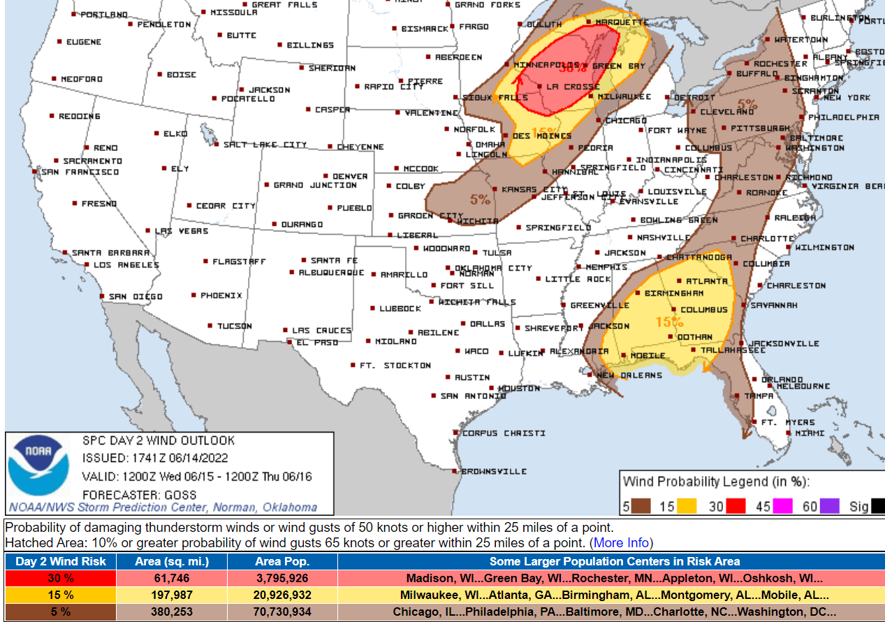
Highest risk zone from eastern Twin Cities into Wisconsin and southeast Minnesota.

Go Deeper.
Create an account or log in to save stories.
Like this?
Thanks for liking this story! We have added it to a list of your favorite stories.
We’re tracking a possible severe weather outbreak Wednesday across our region.
NOAA’s Storm Prediction Center paints an enhanced risk zone across western Wisconsin, southeast Minnesota, and northeast Iowa.
Storm timing
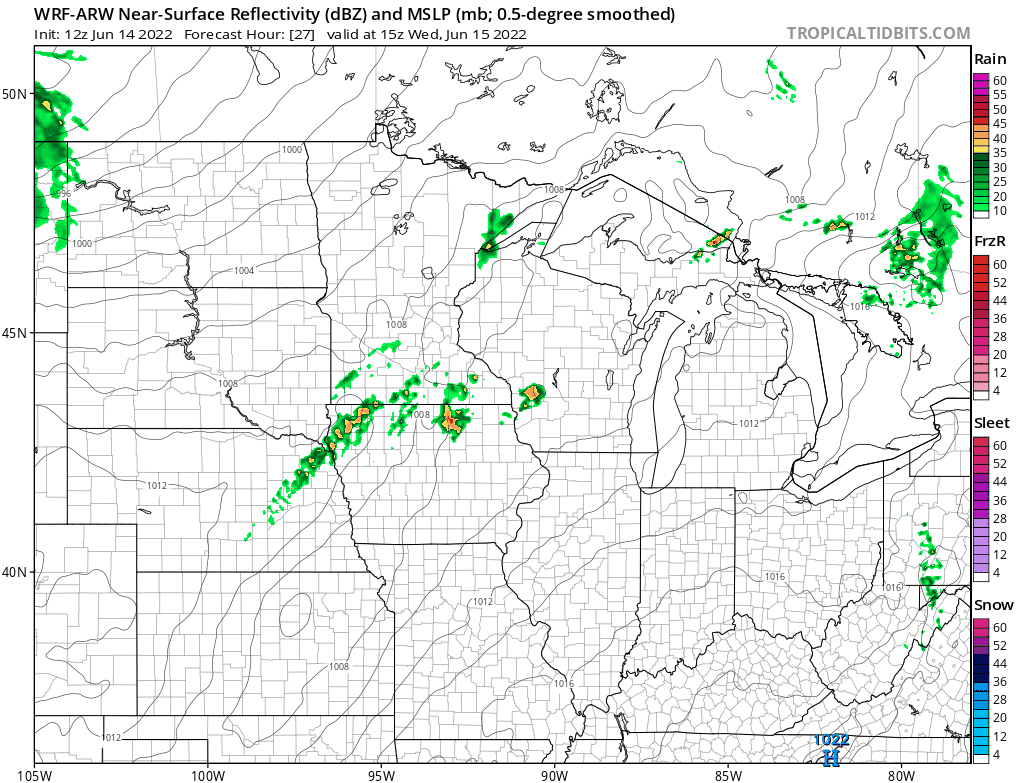
The short-range forecast models vary on timing for rain and thunderstorms across eastern Minnesota Wednesday. A few models suggest rain and possible thunderstorms in the morning hours.
NOAA’s WRF model pains a few cells across southern Minnesota that could clip the Twin Cities area around midday. Most forecast models develop a stronger, possibly severe, line of storms across southeast Minnesota into western Wisconsin during the afternoon hours.
Digging a little deeper, NOAA’s outlook suggests a five percent chance of damaging winds Wednesday within 25 miles of any point in the eastern Twin Cities. That number rises to thirty percent for southeast Minnesota and Wisconsin.
Stay alert for possible severe weather watches and warnings Wednesday.
Turn Up Your Support
MPR News helps you turn down the noise and build shared understanding. Turn up your support for this public resource and keep trusted journalism accessible to all.