

Billion-dollar rain? Storms soaked Minnesota's driest cropland Tuesday night
Thunderstorms possible Saturday night or Sunday
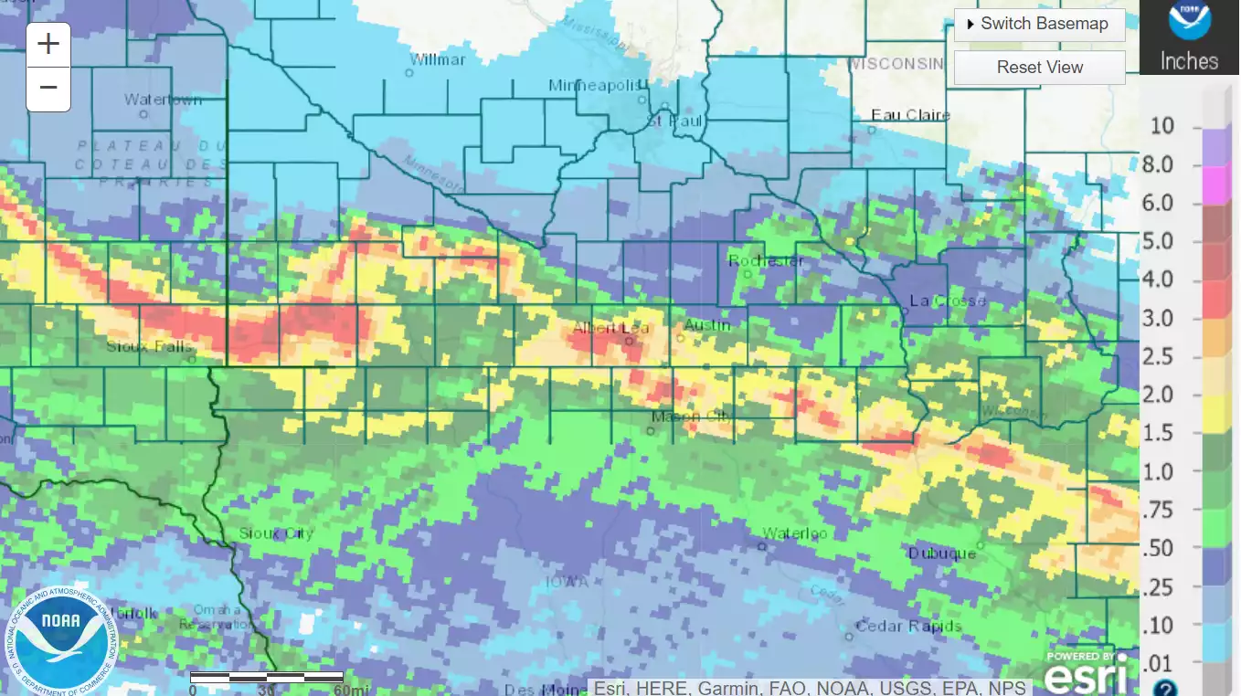
July 5 rainfall totals.
National Oceanic and Atmospheric Administration
Go Deeper.
Create an account or log in to save stories.
Like this?
Thanks for liking this story! We have added it to a list of your favorite stories.