Updraft® - Minnesota Weather News

After frost, warmer temperatures ahead

Sunshine and light winds Wednesday
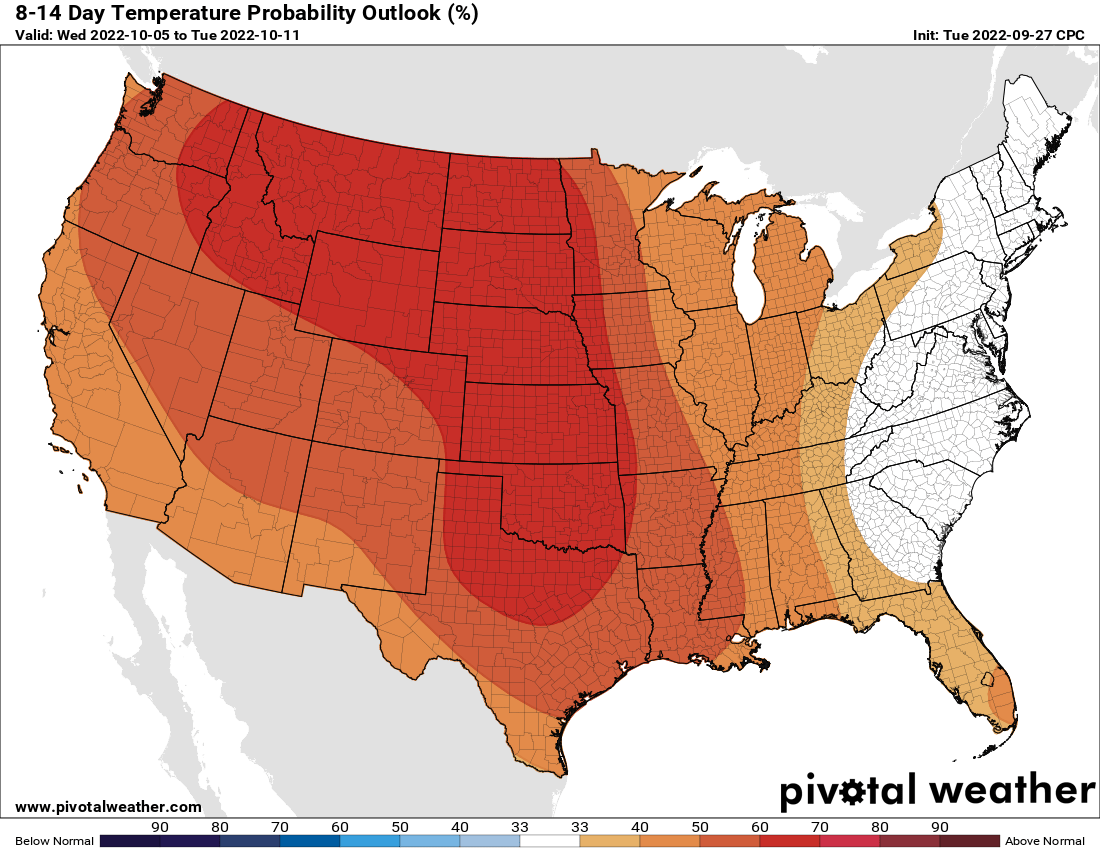
8 to 14 day
8-14 day temperature outlook
National Oceanic and Atmospheric Administration, via Pivotal Weather

After the frosty start, temperatures will be warmer Wednesday afternoon, and the trend continues into the weekend. Dry weather persists the remainder of the week.

Low temperature roundup Wednesday

It was the coldest morning since April 28 across much of Minnesota. The cold spot was Embarrass in northeastern Minnesota at 23 degrees with lots of other 20s nearby.

northern MN lows
Low temperatures across northern Minnesota early Wednesday
National Weather Service

Within the Interstate 494-Interstate 694 urban heat island, we saw temperatures stay above freezing. Minneapolis and St. Paul both bottomed out at a comparatively balmy 37 degrees.

Many outer suburbs saw at least patch frost. Farther out most places saw widespread frost or even freezing temperatures. Lakeville dipped to 28 degrees while Eden Prairie hit 33 and South St. Paul came in at 36.

southern MN lows
Low temperatures across southern Minnesota and the Twin Cities area early Wednesday
National Weather Service

Sunshine and much lighter winds will prevail on Wednesday and it will already be a bit warmer with afternoon highs warming back into the 60s for much of southern and western Minnesota.

wed highs 9am
Forecast high temperatures Wednesday
NOAA, via Pivotal Weather

Temperatures will be warmer yet on Thursday and we’ll see 70s become more widespread across southern and western Minnesota Friday.

fri highs 8am
Forecast high temperatures Friday
NOAA, via Pivotal Weather

Warmer than normal pattern sets up

Temperatures will continue to warm into the weekend with an overall above-normal temperature pattern into next week heading into the first several days of October, if not into the second week or longer.

850 T loop
Forecast temperature anomalies for the next 7 to 10 days
NOAA, via Pivotal Weather