Warmth lingers: 70s in the first week of November?
Halloween looks as good as it gets this year for trick-or-treaters

Go Deeper.
Create an account or log in to save stories.
Like this?
Thanks for liking this story! We have added it to a list of your favorite stories.
The fall 2022 warm weather hits just keep on coming.
Upper air and surface forecast maps push yet another unseasonably warm air mass into Minnesota starting this weekend and peaking later next week. Temperatures around 20 degrees above average look likely by late next week.
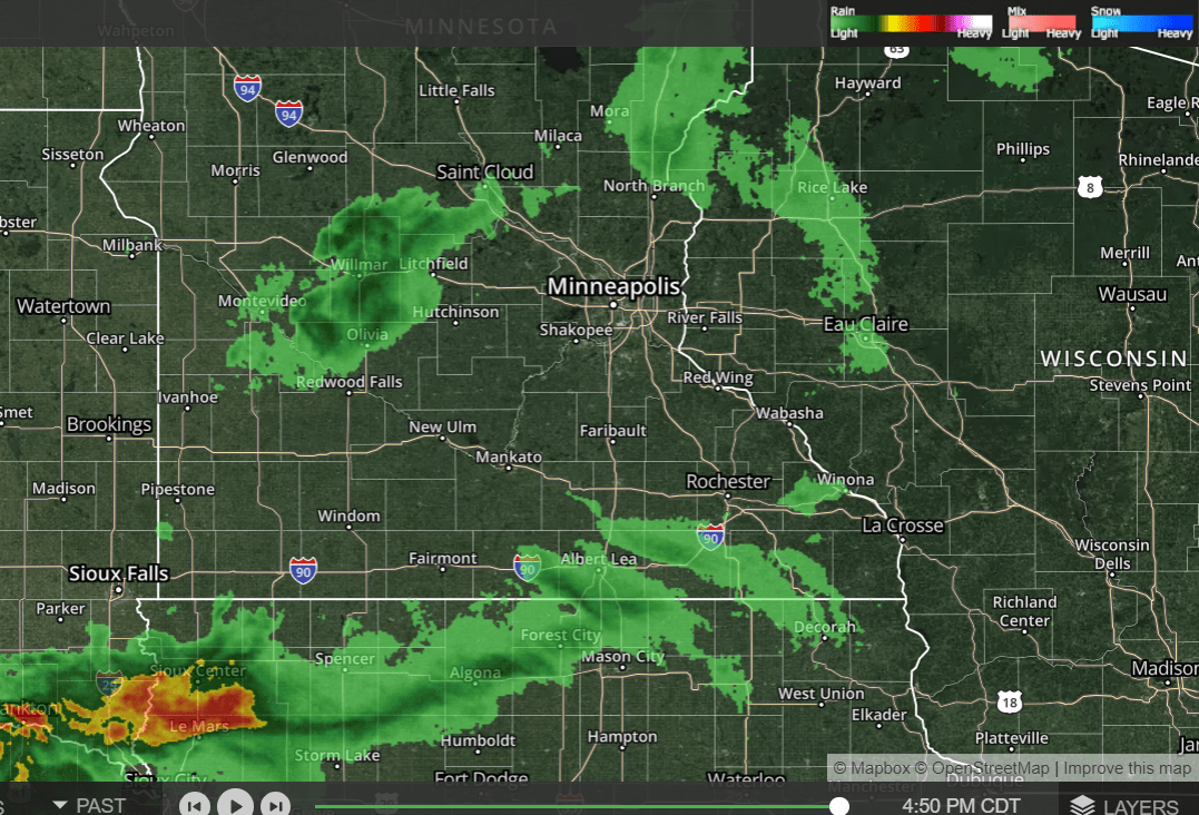
First, we pine for the few light showers that will move across Minnesota overnight. Unfortunately, rainfall will be light and not a significant factor in easing our extreme drought. Remember, you can check out our interactive radar images on the MPR News weather page.

Sunshine returns to Minnesota from west to east on Friday. Highs will be in the 60s for southern Minnesota Friday through the weekend.
Turn Up Your Support
MPR News helps you turn down the noise and build shared understanding. Turn up your support for this public resource and keep trusted journalism accessible to all.

Perfect Halloween?
Halloween looks as good as it gets this year for trick-or-treaters in Minnesota. Sunshine, light winds and mild temperatures will make for one of the best Halloweens on record.

Here’s the full rundown on Minnesota’s Halloween climate history from the Minnesota State Climatology Office.
Halloween is typically a time of crunchy leaves on the ground, a bit of chill in the air, and lots of candy. High temperatures in the Twin Cities are generally in the 40s and 50s. It is more common for the daily high on Halloween to be in the 60s than in the 30s. 70s tend to be rare, with only eight Halloween high temperatures being 70 degrees or above or about one in eighteen years. The warmest Halloween on record was 83 degrees in 1950, with one of the coldest one year later with a high of 30 in 1951. The coldest Halloween maximum temperature was a bone-chilling 26 degrees back in 1873. The last twenty-five years have had some balmy Halloween afternoons, like the 71-degree F high in 2000. We've had some chilly ones as well, like in 2017, when the temperature never rose above 35 F at MSP. The area has not seen a Halloween washout, with measurable precipitation during the evening, since 1997.
Measurable precipitation has occurred on Halloween only 26% of the time in the Twin Cities, or 38 times out of 145 years. The most rain recorded was in 1979 with .78 inches. In 1991 .85 inches of precipitation fell, which was snow. In spite of the 1991 Halloween Blizzard, measurable snow on Halloween is about as rare as getting a full-sized candy bar in your trick-or-treat bag. Since 1872 there's been enough snow to measure only six times: 0.6 in 1884; 0.2 in 1885; 1.4 in 1932; 0.4 in 1954; 0.5 in 1995; and of course 8.2 inches, with the opening round of the Halloween Blizzard in 1991. Thus there has been measurable snow on only 4% of the days.
70s in November?
Next week’s weather maps look unseasonably warm. Highs in the mid to upper 60s look very likely for the Twin Cities and southern Minnesota next week.

And 70s look possible late next week. The National Oceanic and Atmospheric Administration’s Global Forecast System model is cranking out highs well into the 70s by late next week.

That’s still a long way off, so we’ll see if the magnitude and duration of the warmup pan out.
Stay tuned.


