14th largest snowfall event for Twin Cities; quieter weather ahead
Biggest snowfall in about 5 years for the Twin Cities.

Go Deeper.
Create an account or log in to save stories.
Like this?
Thanks for liking this story! We have added it to a list of your favorite stories.
It was the biggest snowfall event for the Twin Cities in almost 5 years.
This week’s unstoppable storm brought 15 inches of snow to MSP Airport. That’s enough to crack the record books in multiple places.
14th largest snowfall on record (1884)
4th largest January snowfall on record
4th wettest (water content) January snowfall on record. (1.29” liquid)
Another multi-part storm
This week’s storm continues the recent trend of storms with multiple acts. The Minnesota Climate Working Group shared some interesting perspectives on this system. Here are some key excerpts.
The new year greeted Minnesota with another large, messy winter storm, as a concoction of heavy snow, freezing rain, sleet, rain, and thunderstorms pounded parts of the state from Monday January 2nd through Thursday January 5th, 2023. The storm produced widespread accumulations of over one foot, and broke into top-20 for storm-total snowfall in the Twin Cities.
This was a "warm" winter storm, only loosely connected to cold air, and totally lacking the intrusion of bitter air that often accompanies or follows Minnesota's strong winter storm systems. Instead, temperatures began in the 10s and 20s F, but warmed through Tuesday and Wednesday, with stations throughout southern and eastern Minnesota climbing above 32 degrees F for a time, even as winds blew from the north.
Like November's powerful fall storm, the mid-December slush storm, and even the pre-holiday snowstorm and ground blizzard, this one sprawled over multiple days, taking numerous "breaks" along the way. This 48 to 72-hour storm had three distinct phases, as low pressure moved from the Texas panhandle on Monday, into Iowa on Tuesday, before stalling in Wisconsin Tuesday night and weakening over the next 1-2 days.

Here’s more detail on the 3 distinct phases of the 14th largest snowfall in Twin Cities history.
Turn Up Your Support
MPR News helps you turn down the noise and build shared understanding. Turn up your support for this public resource and keep trusted journalism accessible to all.
Phase 1: Narrowly Focused Snow and Ice in Southern Minnesota
During the first phase, as deep moisture surged into far southern Minnesota, a narrow band of snow formed over southwestern and far southern parts of the state during Monday, and lasting into the night in some areas. The snow mixed with and turned to sleet and freezing rain to the east of I-35, leaving a moderate glaze on many surfaces, along with very slick roads. Lighter snow and mixed precipitation occasionally spread northward into central Minnesota on Monday and Monday night, but this first phase was really concentrated in the southern three tiers of counties, where many areas received around a half-inch of precipitation. Snowfall up to 8 inches was reported in southwestern Minnesota near Pipestone and Edgerton, with 1-3 inches common eastward along I-90.
Phase 2: Intense Snow and Ice Accumulations Rates
Phase two was the highly-anticipated "main event," and began on Tuesday morning as an area of heavy mixed precipitation and freezing rain turned to very heavy snow as it drifted northward through the day. In most of southern and central Minnesota the heaviest precipitation only lasted 2-3 hours, but was rather extreme, with lightning and thunder accompanying rapidly accumulating ice in far southern areas, and the snow dropping visibility to a tenth of a mile at times as it accumulated at rates of up to two inches per hour in the Twin Cities and much of the rest of southern and central Minnesota. The fast-hitting precipitation blitz stopped abruptly, ending by late morning in the far south, and in the afternoon in the Twin Cities, the upper Minnesota River valley, and central Minnesota. Much of southern and central Minnesota received 3-8 inches of snow during this time, with the most out near Redwood Falls, and generally 3-6 inches around the Twin Cities. The MSP airport closed out the day with 6.0 inches.
Phase 3: Overnight Surprise, with More Snow through Wednesday Night
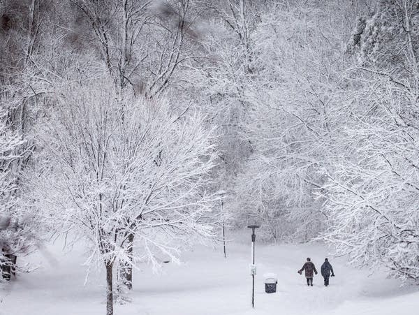
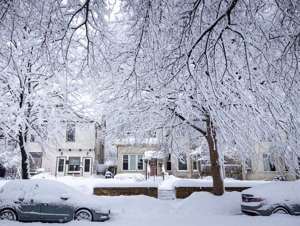
A final phase of snow had been expected to bring light to moderate snow to much of central and eastern Minnesota from Tuesday night into early Thursday. This snow was expected to accumulate about 1-3 inches Tuesday night, and again on Wednesday. Residents of the Twin Cities, however, particularly in the near-southern suburbs, awoke Wednesday to find that the snow they had cleared the previous night had been entirely replenished, and even doubled in some places. Indeed, several vigorous bands of snow dropped an additional 3-7 additional inches overnight across much of southern and central Minnesota, with areas near Bloomington, Burnsville, Lakeville, and Woodbury receiving 7-10 inches of overnight snow. This was a heavy, sticky snow that coated tree branches and had a rough and textured appearance, as opposed to the smooth, laminar look of snow blankets that form in colder conditions.
The snow continued falling through Wednesday, with the heavier snow focusing on the northern suburbs and much of central Minnesota. The snow had ended across all of Minnesota by Thursday morning.

High water content
This storm was packed with high water content from the Gulf of Mexico. Our recent series of storms has already guaranteed above-average precipitation for this meteorological winter.
This was an unusually "wet" (high moisture content) storm for January, though it was not an all-time record-setter and was not unprecedented. Much of southern and central Minnesota received over three-quarters of an inch of precipitation, and quite a few communities recorded over an inch of total precipitation. Rochester broke a daily precipitation record for January 3rd, with 1.12 inches, falling almost entirely as freezing rain and rain, with only 0.9 inches of snow reported for the date. In the Twin Cities, 1.26 inches of precipitation had been recorded from January 3rd through noon on January 4th, ranking this system third all-time for 2-day precipitation totals during January.
For reference, one inch of precipitation exceeds the normal precipitation for the entire month of January in all but far northeastern Minnesota, based on 1991-2020 averages. Thanks to this system, and the very stormy December, over a third of the state is now guaranteed to have above-normal precipitation for the December-though-February meteorological winter. This is quite a feat, considering it was accomplished only about 40% of the way through the season!
This storm was the latest in a sequence of rather large and intense winter weather systems to affect Minnesota. Through January 4th, each of Minnesota's five first-order climate stations had above-normal snowfall for the season to date, ranging from 16% snowier than normal at International Falls, to 136% snowier than normal in the Twin Cities.
Quiet forecast
Now we look ahead to a more typical January weather pattern through the upcoming weekend. There’s abundant snow to play in. We’ll enjoy plenty of sunshine through the weekend.
Highs will run in the lower 20s south, with teens across the north.

Overnight lows will hover on either side of zero up north, with mostly single digits south.

Next week looks mostly quiet with highs in the 20s to lower 30s.
A few models suggest a chance for at least some snow later next week. But the storm track favors steering most of the moisture and energy from California's series of atmospheric river events south of Minnesota next week.
Stay tuned.


