What January? Minnesota rain, Iowa tornadoes, and a sloppy winter storm later this week
Our super warm January is producing an active and highly unusual weather pattern.
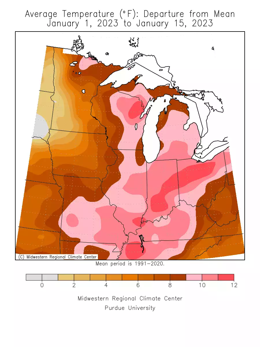
Go Deeper.
Create an account or log in to save stories.
Like this?
Thanks for liking this story! We have added it to a list of your favorite stories.
Welcome to the January of the future, Minnesota.
We’re halfway through January and meteorological winter. The first half of January is running off the charts for warmth. Temperatures are running between 6 and 12 degrees warmer than average across most of Minnesota so far.
Here are some select locations around our region with January temperatures compared to average so far this month.
Grand Forks, ND +3.3 degrees
Twin Cities +6.2 degrees
Rochester +7.3 degrees
Duluth +9.4 degrees
International Falls +12.0 degrees
Our MLK Day rain event is highly unusual for mid-Janaury. As of this post, the Twin Cities has picked up a third of an inch of rainfall. Rain will change to wet slushy snow tonight with the most significant accumulations across northeast Minnesota.
Support Local News
When breaking news happens, MPR News provides the context you need. Help us meet the significant demands of these newsgathering efforts.
Iowa tornoades
January 16 also brings unusual out-of-season tornadoes to central Iowa.
At least 4 preliminary tornado reports came in from near I-90 east of Des Moines.
Major wet snow event Thursday?
All signs point to another heavy wet snow event for southern Minnesota late Wednesday through Thursday. The Canadian and European models paint heavy snow bands across southeast Minnesota into Wisconsin with the Twin Cities on the edge of heavier snowfall.
Here’s the Canadian model loop.
The highest probability for 6” to 12” snowfall totals favors southeast Minnesota at this point. If you live in or are planning to travel in Nebraska, Iowa, southeast Minnesota, and Wisconsin you are likely to get heavy snow by Thursday.
Any further storm track shift north would potentially increase snowfall totals for the Twin Cities area. Any shift south would reduce totals. This looks like another wetter-than-average January storm. January snows are historically dry in Minnesota.
Stay tuned.