

Not done yet; additional snow waves into early Thursday
Highs winds and several more inches of snow into Thursday morning.

Go Deeper.
Create an account or log in to save stories.
Like this?
Thanks for liking this story! We have added it to a list of your favorite stories.
This has been a finicky storm.
Our snowfall is coming in waves with this system. We get bursts of snow punctuated by lulls in the action.
As of this late evening update, satellite and radar trends, surface observations, and the evening 0Z forecast models suggest at least 2 more waves of vigorous snowfall overnight into Thursday morning.
NOAA’s HRRR model (above) shows a couple more pulses of moderate to heavy snow. The first likely crosses the greater Twin Cities area in the hours surrounding midnight. The second likely arrives between about 4 and 7 am, just before morning rush hours.
Support Local News
When breaking news happens, MPR News provides the context you need. Help us meet the significant demands of these newsgathering efforts.
Snow should gradually taper off Thursday later in the morning to midday hours.
Additional snowfall
The 0Z forecast models are staying the course cranking out several more inches of snowfall by midday Thursday. NOAA’s NAM 3 km model is on the lower end with a wide area of 7 to 10 inches.

NOAA’s HRRR and other models still crank out double-digit totals across most of southern Minnesota.

I’ve measured about 8 inches of windswept snowfall so far at the Weather Lab in the southwest Twin Cities as of this post.
If the modeled overnight snowfall verifies it looks like we’ll still end up with snowfall totals in the teens for many areas.
As of this post, blizzard warnings continue for most of southwest Minnesota right up to the western Twin Cities area.
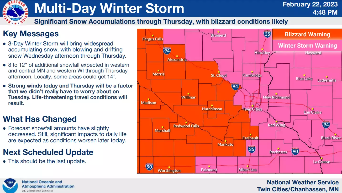
Including the cities of Monticello, Hutchinson, Gaylord, Chanhassen, Chaska, Victoria, Shakopee, St Peter, Le Sueur, Faribault, Mankato, Waseca, Owatonna, Fairmont, Blue Earth, and Albert Lea
900 PM CST Wed Feb 22 2023
...BLIZZARD WARNING REMAINS IN EFFECT UNTIL NOON CST THURSDAY...
* WHAT...Blizzard conditions. Additional snow accumulations of 5 to 10 inches. Storm total accumulations of 12 to 18 inches. Winds gusting as high as 35 mph.
* WHERE...Portions of central, east central and south central Minnesota. * WHEN...Until noon CST Thursday.
* IMPACTS...Travel could be very difficult. Widespread blowing snow could significantly reduce visibility. The hazardous conditions could impact the morning commute.
Expect very difficult travel conditions through Thursday morning.