Storm put Twin Cities within reach of Top 10 snowiest winter
Forecast models performed OK

Go Deeper.
Create an account or log in to save stories.
Like this?
Thanks for liking this story! We have added it to a list of your favorite stories.
Our finicky storm saved the best for last.
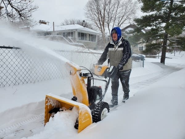
Thursday morning’s intense snow burst brought snowfall totals around the Twin Cities and southern Minnesota into the 12 to 20-inch range.
The 13.1 inches of snow at Minneapolis-St. Paul International Airport ties for the 23rd largest snowfall on record in the Twin Cities.
While the airport saw just over 13 inches, 20 inches fell in Apple Valley, about 10 miles south. A microscale heavy snow band late Wednesday hovered over the Apple Valley area, likely producing the big snowfall difference over a fairly short distance.
Turn Up Your Support
MPR News helps you turn down the noise and build shared understanding. Turn up your support for this public resource and keep trusted journalism accessible to all.
Here are some select snowfall totals as of late Thursday afternoon. (Make sure to check the time of the snowfall report on the link above for the latest info.)
Taunton, Lyon County, southwest Minnesota, 21 inches
Apple Valley, 20 inches
North Mankato, 18 inches
Prior Lake, 17.5 inches
Savage, 17.1 inches
Burnsville, 16.9 inches
NE Minneapolis and Faribault, 16.7 inches
Hopkins, 16.4 inches
Oakdale, 15.5 inches
Golden Valley, 14.5 inches
St. Paul (Highland Park), 13.8 inches
Rochester 13.5, inches
Minneapolis-St. Paul International Airport, 13.1 inches
St. Cloud area, 10 inches
Duluth, 6.4 inches
Forecast models did OK
So how did the forecast model snowfall forecasts perform in the end with this system? Here are some observations.
The models gave an excellent lead time on a 12 inches-plus snowfall event a week in advance.
The models correctly predicted the timing for the onset of snowfall Tuesday afternoon.
The models correctly predicted a lull within the storm Wednesday morning and midday.
Many models did not project the snowfall lulls would last as long as they did Wednesday afternoon.
The models correctly predicted the heaviest snow burst at the end of the system Thursday morning.
Overall, the 50th percentile snowfall total projection forecast on Sunday was not far off from the range of 13 to 20 inches across southern Minnesota.
While this storm did dump a hefty 12 to 21 inches of snow across southern Minnesota, some of the higher-end snowfall output in the mid-20s did not come to pan out. But most forecasters communicated these were the higher end of the possible range.
One additional note. Forecasters use snowfall ranges for a couple of reasons. First, snow events typically produce a wide range of amounts over a relatively small area like the Twin Cities. This storm is a great example.
Also, snowfall ranges communicate the inherent uncertainty within the forecast models, and help weather consumers prepare for the range of possible outcomes.
And it’s good to remember that snowfall totals are just one important element in the overall forecast. Snowfall timing, intensity, water ratio, wind velocity, and temperatures have a major impact on conditions.
Everyone focuses on snowfall totals, but an inch of snow at 10 degrees can do more damage than a foot at 30 degrees.

17th snowiest winter on record
This latest snow blitz gives us 73.5 inches of snow this season in the Twin Cities. That’s good enough for the 17th-highest season snowfall overall. We’re just a few inches shy of a top 10 spot. And it’s still February.
Classic weekend ahead
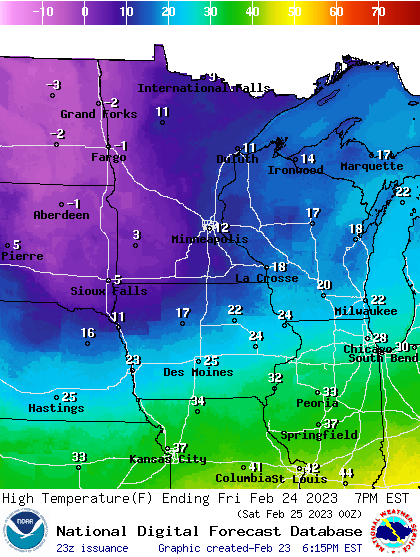
This storm had a good supply of arctic air. Lows will dip below zero Friday morning across our region. Highs Friday hover in the teens.

Temperatures return to the 20s and 30s by Sunday. And yes, those are 60s as close as Kansas City.

It will be a great weekend to get out and play in all that snow.


