Monday snow showers ebb; significant snow potential Thursday into Friday
Temperatures will be seasonable in the 30s south and 20s northwest

Go Deeper.
Create an account or log in to save stories.
Like this?
Thanks for liking this story! We have added it to a list of your favorite stories.
Scattered snow showers will wind down Monday. Tuesday will be dry before a storm system develops late Wednesday into early Friday. Significant snowfall is looking likely late Thursday into Thursday night.
Snow showers diminish Monday
Some areas saw substantial snowfall amounts with bursts of snow that moved through Sunday evening. Some of those heavier bands contained thunder snow. The snow continues around Duluth Monday.


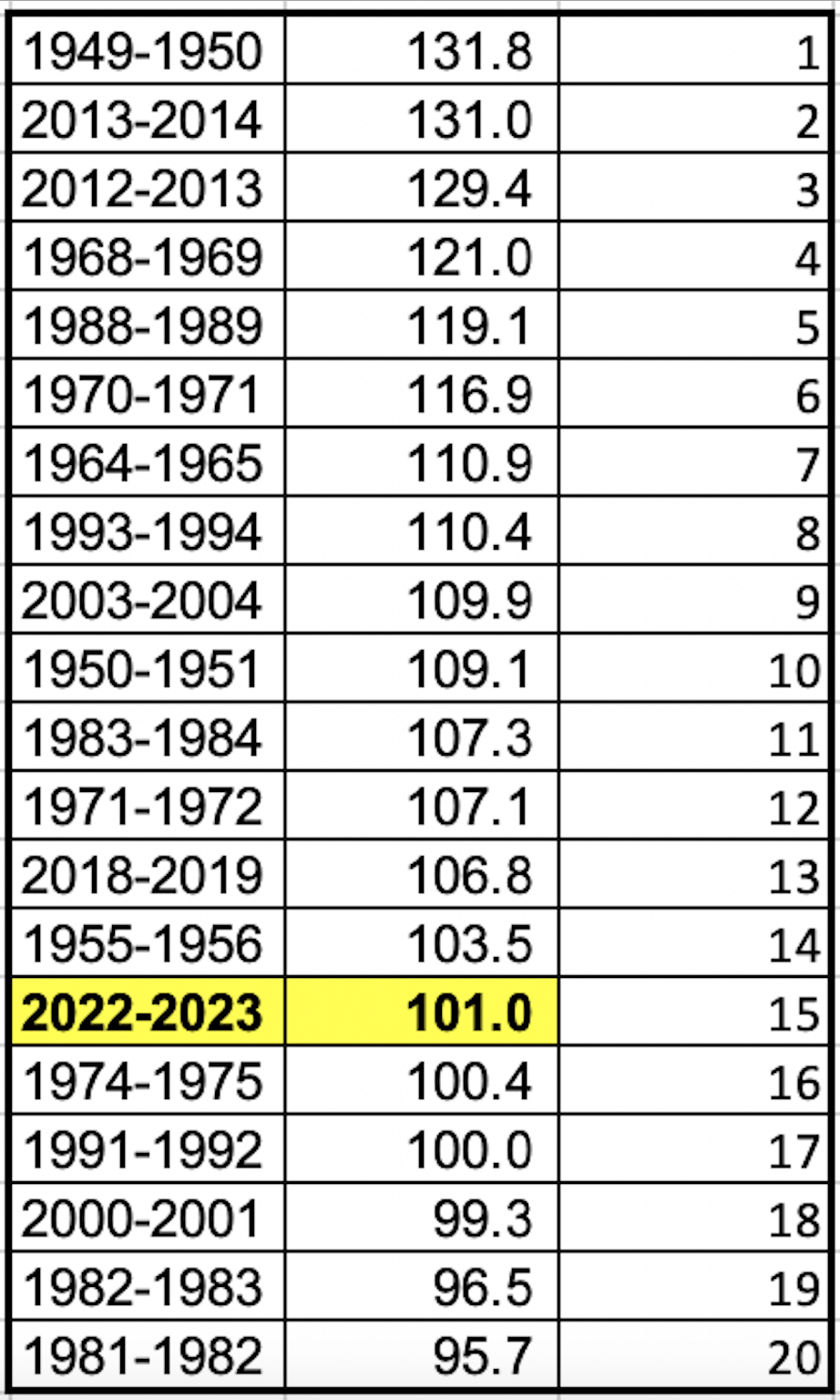
The snowfall was enough to push us up through the seasonal snowfall rankings. The Twin Cities is now at the 13th snowiest winter:

In Duluth, they’re sitting at the number 15 spot with additional snow falling Monday.
Turn Up Your Support
MPR News helps you turn down the noise and build shared understanding. Turn up your support for this public resource and keep trusted journalism accessible to all.

Scattered snow showers will continue Monday and wind down through the day.

Additional snowfall accumulations will generally be light but there will be isolated pockets of higher amounts near Lake Superior.

Potential for significant snow late Wednesday into early Friday
The focus is shifting toward the next storm system. Snow showers will develop late Wednesday into early Friday with the bulk of the heavy snow falling late Thursday through Thursday night.

It increasingly looks likely we’re in for a significant (more than 6 inches) snowfall late this week. This will put the Twin Cities into top 10 seasonal snowfall placement.
The models still differ on total amounts and placement of the heaviest snowfall but you can see the general consensus among several models is a big snow for southern Minnesota.


