Below-normal temps, some snow showers; larger system late this week
Temperatures will continue to be cool with a coating of snow late Tuesday for some

Go Deeper.
Create an account or log in to save stories.
Like this?
Thanks for liking this story! We have added it to a list of your favorite stories.
Below-normal temperatures will continue to prevail this week but so will a slow thaw. Snow showers will bring a coating of snow to central and northern Minnesota Tuesday into Tuesday night. A larger storm could bring more rain and snow Thursday into Saturday.
Quiet Monday; snow coating for some Tuesday
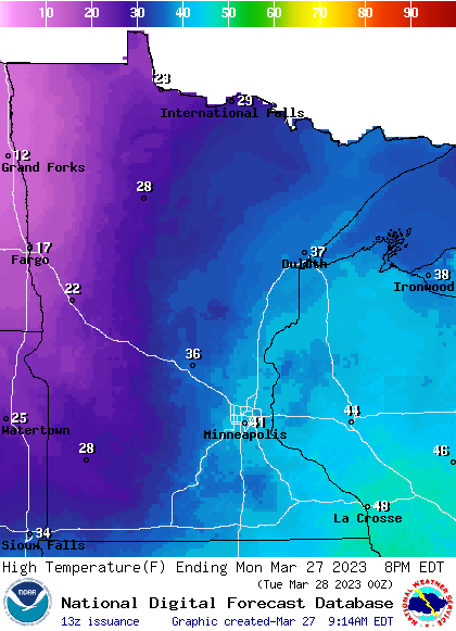
We’ll have a decent, quiet Monday with a mix of high clouds and sunshine. High temperatures will be below normal still, ranging from the low 40s in the southeast to just the teens in northwestern Minnesota.
A quick moving clipper system will bring snow showers to much of Minnesota midday Tuesday into Tuesday night.

Snowfall accumulations will be light with a coating of snow for many places.
Turn Up Your Support
MPR News helps you turn down the noise and build shared understanding. Turn up your support for this public resource and keep trusted journalism accessible to all.

Cooler midweek; larger storm late week
Wednesday will be cooler behind the Tuesday clipper with below freezing high temperatures nearly statewide, which is not particularly common in the final days of March.

A larger, prolonged storm system develops Thursday into Saturday with two main rounds of snow.

The first round of snow will be possible across northern Minnesota late Thursday.

The second round is more uncertain with possible snowfall somewhere in central Minnesota or southern Minnesota into Iowa late Friday. We’ll also see rain during the daylight hours, especially south.


