Thunderstorm chances linger with steamy temps, dew points
Late day thunder chances persist into the weekend

Go Deeper.
Create an account or log in to save stories.
Like this?
Thanks for liking this story! We have added it to a list of your favorite stories.
Updated 9:30 a.m.
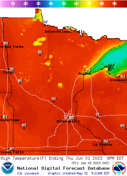
Wednesday will be another warm and unsettled day. Look for highs in the mid to upper 80s with sticky dew points. Spotty thunderstorms will redevelop late afternoon into the evening in some areas.
Hot, muggy; more late-day thunder chances
It’s rinse and repeat these next several days. Partly cloudy skies will heat things back up to near 90 for much of southern Minnesota Wednesday afternoon. Northern Minnesota will be well into the 80s with cooler readings, mainly in the 70s near the North Shore of Lake Superior.

The combination of very warm temperatures and sticky dew points in the 60s will lead to destabilization in the atmosphere each afternoon and evening.
Spotty storms again pop up Wednesday afternoon into the overnight especially west and north with more of an isolated chance in the east, including the Twin Cities area.

A nearly identical scenario will play out each of the next several days through the weekend with late afternoon and evening isolated thunderstorm chances. Minnesota stays steamy with highs near 90 in the south and west and 80s north.

Record highs Thursday and Friday are only in the low 90s for the Twin Cities, so we could be in record territory with warm overnights as well. These readings are well above normal for early June.

Turn Up Your Support
MPR News helps you turn down the noise and build shared understanding. Turn up your support for this public resource and keep trusted journalism accessible to all.


