

Rainfall recap; details on Minnesota, Wisconsin air quality alerts
Weekend temps retreat a bit
Go Deeper.
Create an account or log in to save stories.
Like this?
Thanks for liking this story! We have added it to a list of your favorite stories.
We need some rain.
The U.S. Drought Monitor report released Thursday showed 63.65 percent of Minnesota in drought, with 11.25 percent (shaded orange) in severe drought and 52.40 percent (shaded beige) in moderate drought:

The yellow-shaded areas — 36.35 percent of Minnesota — are abnormally dry, but not yet in drought. For the first time this year, 100 percent of Minnesota was listed as either abnormally dry or in drought.
The showers and thunderstorms Thursday afternoon and evening were helpful in a few areas, but most locations didn’t see meaningful rainfall totals. Here’s the rainfall map from 7 a.m. Thursday to 7 a.m. Friday:
Support Local News
When breaking news happens, MPR News provides the context you need. Help us meet the significant demands of these newsgathering efforts.

Notice the streaks of rain along the tracks of the strongest thunderstorms. Areas shaded green had anywhere from one-half of an inch (.50) to one-and-one-half (1.50) inches of rain.
The Community Collaborative Rain, Hail and Snow Network, a volunteer observer network, posted this 24-hour rainfall plot:

I circled the 1.30-inch rainfall total in Paynesville and the 1.05-inch total near Belgrade, both towns in Stearns County. There wasn’t any measureable rain just a few miles to the south and southwest of those two locations.
Belgrade also had baseball-sized hail around 6:10 p.m. Thursday:
The official Thursday evening rainfall total at Minneapolis-St. Paul International Airport was 16 one-hundredths (.16) of an inch. Holman Field near downtown St. Paul reported 49 one-hundredths (.49) of an inch.
Friday rain chances
There is a bit of instability in the atmosphere Friday, so a few scattered showers and thunderstorms are possible in Minnesota and western Wisconsin later this afternoon and evening.
You can hear updated weather information for Minnesota and western Wisconsin on the MPR News network. You can find the latest radar here.
You can also check these National Weather Service sites for updated weather info: Twin Cities, Duluth, La Crosse, Wis., Sioux Falls, S.D., and Grand Forks, N.D.
Air quality alert
At 10 a.m. Friday, the air quality was still good over much of Minnesota, with moderate air quality in northwestern and west-central Minnesota.
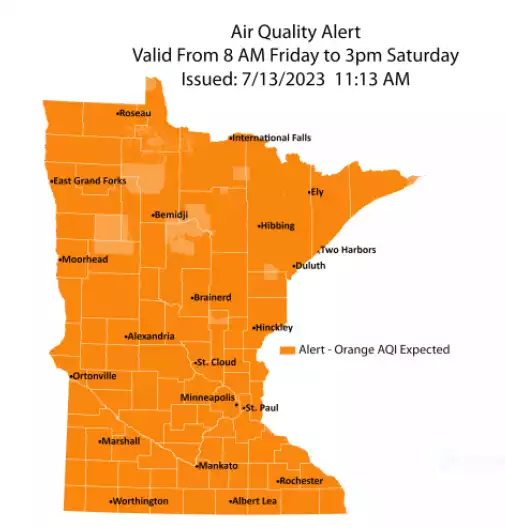
Air quality is expected to deteriorate as we go through Friday afternoon and evening, due to Canadian wildfire smoke mixing down to ground level. The Minnesota Pollution Control Agency posted an air quality alert for Minnesota from 8 a.m. Friday to 3 p.m. Saturday:
Here are details of the alert, from the MPCA:
Air quality is expected to reach the orange AQI category across all of Minnesota, which is unhealthy for sensitive groups.
The Minnesota Pollution Control Agency (MPCA) has issued an air quality alert for all of Minnesota due to wildfire smoke. The alert is effective from 8 a.m. Friday, July 14, through 3 p.m. Saturday, July 15. The affected area includes all of Minnesota as well as the tribal nations of Prairie Island, Mille Lacs, Fond du Lac, Upper Sioux, Leech Lake, Red Lake and Grand Portage.
Fine particle levels are expected to reach the orange air quality index (AQI) category, a level considered unhealthy for sensitive groups, all of Minnesota. In the orange area, sensitive groups should limit prolonged or heavy exertion and time spent outdoors.
Smoke from wildfires in Alberta and British Columbia will move south across Minnesota following a cold front on Friday. The sinking air associated with the cold front will push smoke elevated in the atmosphere down to the surface. This will result in poor air quality. Air quality will gradually improve on Saturday with gradual clearing across Minnesota from north to south. This alert may need to be locally extended depending on how fast the smoke dissipates.
What this alert means
Air moves long distances and carries pollutants. During air quality alerts due to wildfires, the air is mixed with harmful smoke. Wildfire smoke spreads or lingers depending on the size of the fires, the wind, and the weather.
The air quality index (AQI) is color-coded. Air quality alerts are issued when the AQI is forecast to reach an unhealthy level, which includes forecasts in the orange, red, purple, and maroon categories. For a full description of each air quality category, visit airnow.gov.
Orange air quality: Unhealthy for sensitive groups
Sights and smells: In areas where air quality is in the orange AQI category due to wildfires, the sky may look hazy and residents may smell smoke even when wildfires are far away.
Health effects: This air is unhealthy for sensitive groups and pollution may aggravate heart and lung disease as well as cardiovascular and respiratory conditions. Symptoms may include chest pain, shortness of breath, wheezing, coughing, and fatigue.
What to do: People in sensitive groups are encouraged to reduce outdoor physical activities, take more breaks, or do less intense activities to reduce their exposure. People with asthma should follow their asthma action plan and keep their rescue inhaler nearby.
Who’s most at risk
Poor air quality impacts health. Fine particle pollution from wildfire smoke can irritate eyes, nose, and throat, and cause coughing, chest tightness, shortness of breath, dizziness, or fatigue. Smoke particles are small enough that they can be breathed deeply into lungs and enter the bloodstream. This can lead to illnesses such as bronchitis or aggravate existing chronic heart and lung diseases, triggering heart palpitations, asthma attacks, heart attacks, and strokes.
Certain groups experience health effects from unhealthy air quality sooner than others, either because they are more sensitive to fine particle pollution or because they are exposed to larger amounts of it.
Sensitive groups include:
People who have asthma or other breathing conditions like chronic obstructive pulmonary disease (COPD).
People who have heart disease, high blood pressure, or diabetes.
Pregnant people.
Children and older adults.
People with increased exposure include:
People of all ages who do longer or more vigorous physical activity outdoors.
People who work outdoors, especially workers who do heavy manual labor.
People who exercise or play sports outdoors, including children.
People who don’t have air conditioning and need to keep windows open to stay cool.
People in housing not tight enough to keep unhealthy air out, or who do not have permanent shelter.
Anyone experiencing health effects related to poor air quality should contact their health care provider. Those with severe symptoms, chest pain, trouble breathing, or who fear they may be experiencing a heart attack or stroke should call 911 immediately.
Take precautions
Reduce or eliminate activities that contribute to air pollution, such as outdoor burning, and use of residential wood burning devices. Reduce vehicle trips and vehicle idling as much as possible. Keep windows closed to ensure outside smoke does not enter you home.
The Wisconsin Department of Natural Resources has issued an air quality advisory for all of Wisconsin that continues from today to noon on Sunday. Here are the details:
WIZ014>016-023>028-161700- Polk-Barron-Rusk-St. Croix-Pierce-Dunn-Pepin-Chippewa-Eau Claire- Including the cities of Osceola, Rice Lake, Ladysmith, Hudson, River Falls, Menomonie, Durand, Chippewa Falls, and Eau Claire 859 AM CDT Fri Jul 14 2023 ...AIR QUALITY ALERT IN EFFECT UNTIL NOON CDT SUNDAY... The Wisconsin Department of Natural Resources has issued an Air Quality Advisory for PM2.5 which will be in effect until noon Sunday, July 16. This advisory affects all of Wisconsin. Smoke originating from wildfires in western Canada will move into the state today, generally from northwest-to-southeast, causing the air quality index (AQI) for PM2.5 to reach the Unhealthy for Sensitive Groups (USG) level. It is possible that isolated to scattered areas of Unhealthy AQI PM2.5 could develop, with the best chance for this to occur across southern Wisconsin. People with heart or lung disease, older adults, and children should consider avoiding prolonged or heavy exertion. Everyone else should consider reducing prolonged or heavy exertion. The northern half of the state will see the heaviest smoke impacts from noon Friday until midnight Sunday (Saturday night). The southern half of the state will see the heaviest smoke impacts from 6AM Saturday until noon Sunday. While it is likely that this advisory will be allowed to expire as planned for northern Wisconsin, we may need to extend the end-time of the advisory for southern Wisconsin. For more information on current air quality, please see: https://airquality.wi.gov
Weekend outlook
Much of Saturday will be dry, but there could be a few scattered showers and an isolated thunderstorm in far northern Minnesota and parts of western Wisconsin late Saturday afternoon and Saturday evening.
Far northern Minnesota and northwestern Wisconsin could see a passing shower or thunderstorm Sunday and Sunday evening.
Saturday highs will be in the 70s in the northern third of Minnesota, with 80s elsewhere:

Saturday afternoon dew points will be in the summery 50s in most areas, with drier 40s in northern Minnesota:

Sunday high temps will range from 60s in far northern Minnesota to around 80 degrees in the Twin Cities metro area and southeastern Minnesota:

Sunday afternoon dew points will be in comfortable 40s to lower 50s:

Cool start to the week
Twin Cities metro area highs are projected to be in the upper 70s on Monday, followed by lower 80s Tuesday and mid 80s on Wednesday and Thursday.
Programming note
You can hear my live weather updates on MPR News at 7:35 a.m., 9:35 a.m. and 4:39 p.m. each Saturday and Sunday.