

Isolated late-day thunderstorms Monday; heating up this week
Highs could be in the 90s by the weekend
Go Deeper.
Create an account or log in to save stories.
Like this?
Thanks for liking this story! We have added it to a list of your favorite stories.
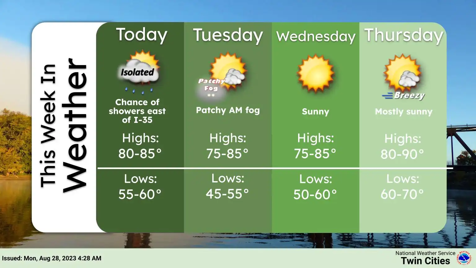
A couple of late day showers or at thunderstorm is possible Monday. We’ll be warmer Monday but temperatures will heat up more by the end of the week.
Warmer Monday; isolated late day thunderstorm
After a cooler weekend, Monday will be warmer in the low to mid-80s.

We’ll also have muggier dew points by the afternoon.

The combination of higher dew points and an upper-level disturbance will create a couple of late day showers or a thunderstorm is possible, mainly in eastern Minnesota and western Wisconsin.
Turn Up Your Support
MPR News helps you turn down the noise and build shared understanding. Turn up your support for this public resource and keep trusted journalism accessible to all.

The chance will be relatively isolated with slightly higher chances northeast.

Here comes the heat again
Tuesday will be a bit cooler with dew points dropping again. We’ll see highs mainly in the 70s with a few low 80s in southern Minnesota.

By later in the week things are heating up again. The familiar heat dome (upper-level high pressure ridge) is building back into the north central United States for the weekend into early next week.

By as early as Saturday we could see highs near 90 in southern Minnesota. Some models give us a string of 90-degree temperatures this weekend into early next week.
