Hottest September day in 92 years possible this weekend
Record heat, elevated fire danger threat Labor Day weekend

Go Deeper.
Create an account or log in to save stories.
Like this?
Thanks for liking this story! We have added it to a list of your favorite stories.
Temperatures in the Twin Cities have reached 100 degrees in September only once in the past 150 years of records. That could change this Labor Day weekend when an unusually hot and dry air mass blows into Minnesota.
Temperatures will easily reach the upper 90s across southern and western Minnesota, and because the air mass is drier than usual it will heat more easily. That means bank thermometers may be flashing 100 degrees in a town near you this weekend.
The hottest September temperature ever recorded in the Twin Cities was 104 degrees on Sept. 10, 1931. It looks like we have a decent chance to see 100 degrees in or very close to the Twin Cities this weekend.
Heat dome builds
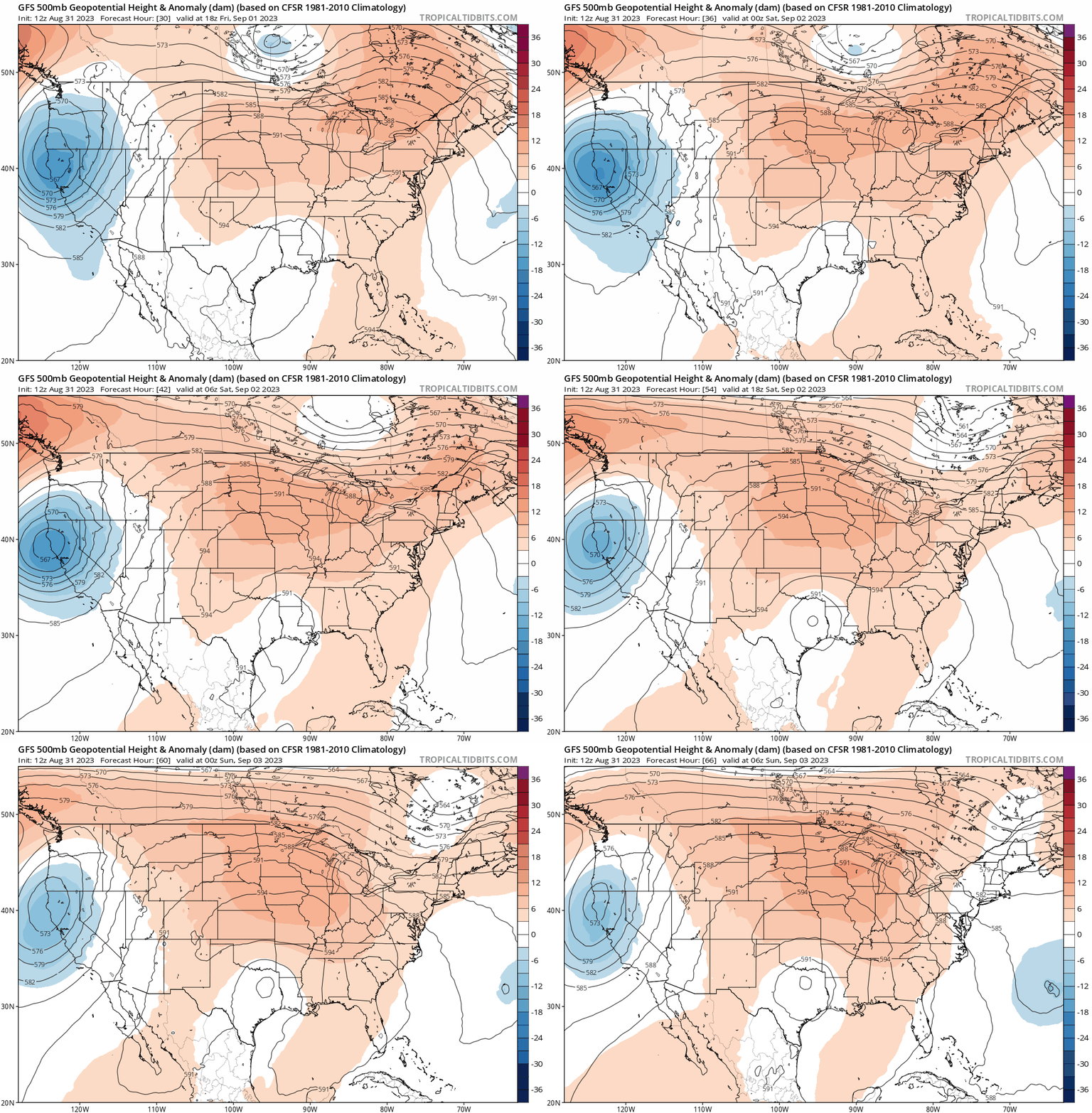
The National Oceanic and Atmospheric Administration’s Global Forecast System and other models continue to show an anomalously warm ridge of high-pressure building across the Upper Midwest this Labor Day weekend.
Turn Up Your Support
MPR News helps you turn down the noise and build shared understanding. Turn up your support for this public resource and keep trusted journalism accessible to all.
The warmer colors on the upper-air loop below signify hotter-than-average temperatures translating to ground level.

Record heat possible
Record highs for the Twin Cities area are in the upper 90s this weekend:
Saturday 97 degrees (1913)
Saturday 97 degrees (1937)
Sunday 97 degrees (1925)
Labor Day 98 degrees (1925)
Highs this weekend will reach or exceed those temperatures across much of southern and western Minnesota. We could see multiple new temperature records set this weekend.
We may hit 90 degrees as soon as Friday. Temperatures will soar well into the 90s by Saturday afternoon.

Right now, Sunday looks like the hottest day this weekend, but Labor Day will be very close.

Fire weather potential
This weekend’s inbound air mass looks unusually dry. A wedge of desert air from New Mexico and the Southwest will blow northward into Minnesota this weekend.
Desert air masses from that part of the world are classified as Continental Tropical (cT) air masses. During heat waves, Minnesota typically sees more humid Maritime Tropical (mT) air masses from the Gulf of Mexico.

But the wind flow this weekend will shove that mT air mass a little farther east than usual.
The record heat and unusually dry air mass may produce very low relative humidity levels this weekend. Relative humidity levels could reach the teens and single digits across southern Minnesota this weekend.
That will create the potential for higher-than-usual fire weather danger.
The Twin Cities National Weather Service office has picked up on that trend and already issued a special weather statement for Friday across much of Minnesota.
Special Weather Statement National Weather Service Twin Cities/Chanhassen MN
331 PM CDT Thu Aug 31 2023
MNZ041>045-047>052-054>059-064>067-073>075-010900- Douglas-Todd-Morrison-Mille Lacs-Kanabec-Stevens-Pope-Stearns- Benton-Sherburne-Isanti-Lac Qui Parle-Swift-Chippewa-Kandiyohi- Meeker-Wright-Yellow Medicine-Renville-McLeod-Sibley-Redwood- Brown-Nicollet-
Including the cities of Alexandria, Long Prairie, Little Falls, Princeton, Mora, Morris, Glenwood, St Cloud, Sauk Rapids, Elk River, Cambridge, Madison, Benson, Montevideo, Willmar, Litchfield, Monticello, Granite Falls, Olivia, Hutchinson, Gaylord, Redwood Falls, New Ulm, and St Peter
331 PM CDT Thu Aug 31 2023
...ELEVATED FIRE WEATHER CONDITIONS FRIDAY AFTERNOON... Hot, dry, and breezy conditions will develop Friday afternoon. Minimum RH values will fall to near 30 percent, and wind gusts of 15 to 25 mph are possible. The worst conditions will be from 12 PM Friday through 7 PM Friday. Looking ahead, these conditions will continue into early next week.
Be careful with fire this weekend Minnesota.


