Updraft®

Northern lights possible Thursday night; quiet weather Friday

Mainly 30s this weekend
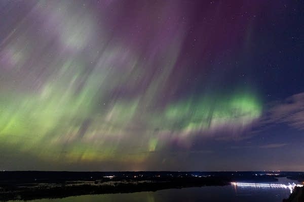
A view of the aurora borealis
Northern lights appear above Lock and Dam No. 5 on the Mississippi River near Winona, Minn. on Sunday, April 23, 2023.
Ben Hovland | MPR News

I’ve seen the northern lights (aurora borealis) twice in my life. The most vivid northern lights that I witnessed were near Park Rapids, Minn., on a summer lake trip a few years ago.

We’ll have a chance to see northern lights Thursday night as a coronal mass ejection from the sun interacts with the Earth’s magnetic field.

Patchy clouds are expected over parts of Minnesota this evening, but those clouds are expected to break up a bit overnight into Friday.

The potential viewing area of the aurora includes most of Minnesota and Wisconsin, according to the National Oceanic and Atmospheric Administration’s Space Weather Prediction Center:

rt1130view
Aurora visibility forecast Thursday night
NOAA Space Weather Prediction Center

The red-shaded area that covers Canada and far northern Minnesota indicates where (weather permitting) the chances of seeing the northern lights are highest Thursday night. The thin red line in southern Iowa shows where aurora may be visible on the northern horizon.

Northern lights often surprise us. Sometimes they are more vivid and extensive than expected and sometimes they are limited in coverage and less vivid than expected.

If you go to NOAA’s Space Weather Prediction site, be aware that they use Universal Time, which is 6 hours ahead of Central Standard Time. Dec. 1 begins at 6 p.m. CST on that site.

The MPR News staff compiled some tips on northern lights viewing and picture-taking.

Back to the 30s

The Thursday high temperature at Minneapolis-St. Paul International Airport was 42 degrees, which is well above the average Nov. 30 Twin Cities high temp of 35 degrees.

The metro area will share highs in the 30s with much of Minnesota and western Wisconsin on Friday:

rt1201h12
Friday forecast highs
National Weather Service

Saturday highs will be mainly in the 30s:

rt1202h12
Saturday forecast highs
National Weather Service

Highs in the 30s linger in most areas on Sunday, with some lower 40s to the southwest:

rt1203h12
Sunday forecast highs
National Weather Service

Twin Cities metro area high temps are projected to reach the upper 30s on Monday, then around 40 degrees Tuesday followed by lower 40s Wednesday and mid-40s next Thursday.

We may have more mild days than cool days in December, according to the temperature outlook from the National Weather Service Climate Prediction Center:

rt1130decout
December temperature forecast
National Weather Service

Weekend flake chances mainly to the southeast

A low-pressure system passes to our southeast this weekend. Some accumulating snow is expected in Iowa and southern Wisconsin late Saturday into Sunday.

Far southeastern Minnesota could see some light snow late Saturday into early Sunday. We can’t rule out a few few flurries Saturday night or early Sunday in the Twin Cities metro area.

The National Oceanic and Atmospheric Administration’s North American Mesoscale forecast model shows the potential precipitation pattern from noon on Saturday to 6 p.m. Sunday:

rt1130rad2
Simulated radar from noon Saturday to 6 p.m. Sunday
NOAA, via Tropicaltidbits.com

You can hear updated weather information for Minnesota and western Wisconsin on the MPR News network.

Programming note

You can hear my live weather updates on MPR News at 7:35 a.m., 9:35 a.m. and 4:39 p.m. each Saturday and Sunday