

More showers and thunder Friday. Storms likely again late Sunday
Warmer temps as active pattern continues
Go Deeper.
Create an account or log in to save stories.
Like this?
Thanks for liking this story! We have added it to a list of your favorite stories.
We’ll have scattered showers and thunder Friday with heavy rainfall potential for southern Minnesota. More storms are possible Sunday and some could be strong.
Warmer temps as active pattern continues
Scattered morning showers will give way to a bit of a midday break Friday with a few peeks of sunshine. High temperatures will warm into the 70s statewide. Northwestern Minnesota will see sun much of the day along with drier weather.

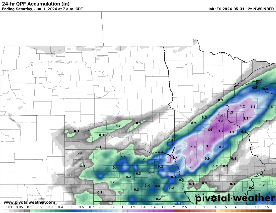
More showers and thunderstorms will develop for southern Minnesota in the afternoon and evening Friday. Those showers could produce heavy rainfall.

One to 2 inches of rain could fall from Redwood Falls in southwestern Minnesota through the Twin Cities and Rochester into western Wisconsin Friday into Friday night. There could be some locally higher amounts greater than 2 inches.
Turn Up Your Support
MPR News helps you turn down the noise and build shared understanding. Turn up your support for this public resource and keep trusted journalism accessible to all.
Saturday should be mostly dry for most of the state. A few showers or a thunderstorm is possible in mainly southeastern and northeastern Minnesota.

Temperatures Saturday will warm to near 80 degrees in southern Minnesota with low 70s north.

Sunday will be warm with highs near 80 again in southern Minnesota.

The pattern remains active into next week. The next rain chance comes Sunday with the potential of strong storms late Sunday into Sunday night. Another system will develop more storms Tuesday into Tuesday night.

The Sunday and Tuesday systems could produce strong to severe storms. There’s a slight risk (level 2 of 5) of severe weather in western Minnesota and a marginal risk (level 1 of 5) for much of the rest of Minnesota.

Overall temperatures will be summerlike with highs mostly in the 70s and 80s into next week for the first week of June.