Lots of sun Tuesday before muggy air and thunder chances return
Temperatures should surpass 80 degrees again Tuesday for many

Go Deeper.
Create an account or log in to save stories.
Like this?
Thanks for liking this story! We have added it to a list of your favorite stories.
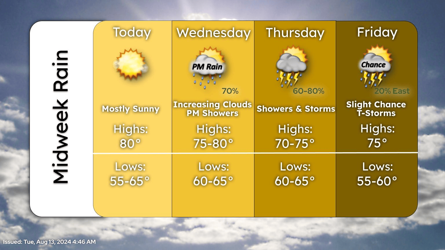
Enjoy a sun-filled Tuesday. We’ll see highs back in the low 80s for many. Muggier air returns Wednesday and that combined with a disturbance will touch off the next chance of thunder.
Warm with lots of sun Tuesday before muggier air and thunder chances return
Tuesday will be a stellar day with lots of sunshine and temperatures right near or slightly above normal, in the upper 70s to low 80s for most.

As high pressure slides east, winds will start to increase out of the south, especially in western Minnesota. That will allow muggier air to start to creep back into Minnesota. Dew points will be back in the “sticky” 60s Wednesday and hang around into the weekend.

The increased moisture will set the stage for the chance of some showers and thunderstorms Wednesday. Activity will develop in western Minnesota first and make its way east by the evening and overnight. We’ll have instability, pop-up thunder possible Thursday and Friday afternoons.
Turn Up Your Support
MPR News helps you turn down the noise and build shared understanding. Turn up your support for this public resource and keep trusted journalism accessible to all.

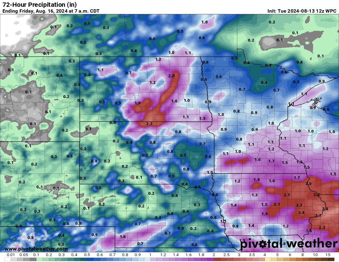
Rainfall looks to be heaviest across southern Minnesota into western Wisconsin. Many areas could see a widespread inch of rain with some places receiving 2 inches.

The rest of the week will see seasonable temperatures, though a bit cooler Thursday and Friday with the increased cloud cover and instability-driven showers.

The weekend looks pretty nice at this point. It should be mainly dry with partly-cloudy skies and seasonable temperatures.
Our recent cool snap was the result of a record Arctic heat-wave
While we saw seven consecutive days of high temperatures below 80 degrees, the Arctic regions of Alaska and northwest Canada were baking. Ft. McPherson and Inuvik both reached 95 degrees last week. Inuvik’s high was an all-time record high. What’s unusual is that this came so late in the summer. Record summer highs typically occur there in July, just like Minnesota.

That extreme, anomalous warmth, pushing deep into northern North America helped to dislodge the cool air mass that descended upon our region. The image below shows the upper level pattern as an upper level high (heat) penetrated into the Northwest Territories of Canada.

The record heat also sparked numerous wildfires in the Northwest Territories. 1.4 million acres burned in just the first 11 days of August in that region alone according to Rick Thoman, a climate specialist at the University of Alaska Fairbanks.


