

Lingering cloud cover and isolated showers; hazy skies continue
Quiet weather for the work week
Go Deeper.
Create an account or log in to save stories.
Like this?
Thanks for liking this story! We have added it to a list of your favorite stories.
Low pressure centered over the Great Lakes region will provide lingering cloud cover and very isolated showers. As high pressure moves in we will see sunshine and quiet weather conditions. Air quality alert continues for northern Minnesota.
Air quality alert
An air quality alert remains in effect until noon on Monday. Northern Minnesota will remain in the orange category, yellow category for central and southern Minnesota.
Turn Up Your Support
MPR News helps you turn down the noise and build shared understanding. Turn up your support for this public resource and keep trusted journalism accessible to all.
“...AIR QUALITY ALERT IN EFFECT UNTIL NOON CDT MONDAY... * WHAT...The Minnesota Pollution Control Agency has issued an Air Quality Alert for fine particles pollution. The Air Quality Index (AQI) is expected to reach the Orange or Unhealthy for Sensitive Groups category.”

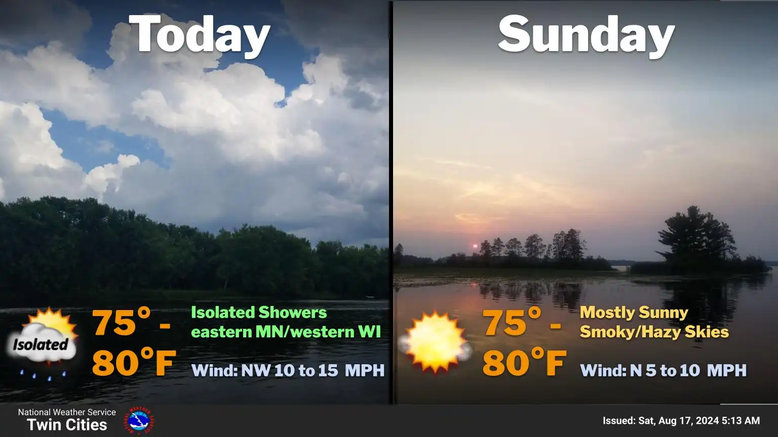
Cloudy start to the weekend
Residual cloud cover from a low pressure system over the Great Lakes region will continue into Saturday afternoon. Partly sunny skies should be developing as this slow moving low exits the region. Isolated rain showers mainly for eastern Minnesota are possible for Saturday afternoon and evening. These showers will be few and far between, and shouldn’t ruin any plans for the day.

High temperatures will be climbing into the upper 70s with dewpoints in the lower to mid 60s.

Lows tonight will drop into the mid 60s, with clearing skies.

Sunshine and seasonal temperatures
Canadian high pressure will move in for Sunday providing ample sunshine and seasonal temperatures. Highs are expected in the low 80s with light winds.
As our high pressure system exits we will see the return of southerly flow. Slightly warmer temperatures in the forecast for the start of the state fair in the mid 80s. Rain chances get reintroduced to the forecast, but at this time remain minimal.
