

Stormy start to Saturday; cooler Sunday
One more day with highs in the 80s
Go Deeper.
Create an account or log in to save stories.
Like this?
Thanks for liking this story! We have added it to a list of your favorite stories.
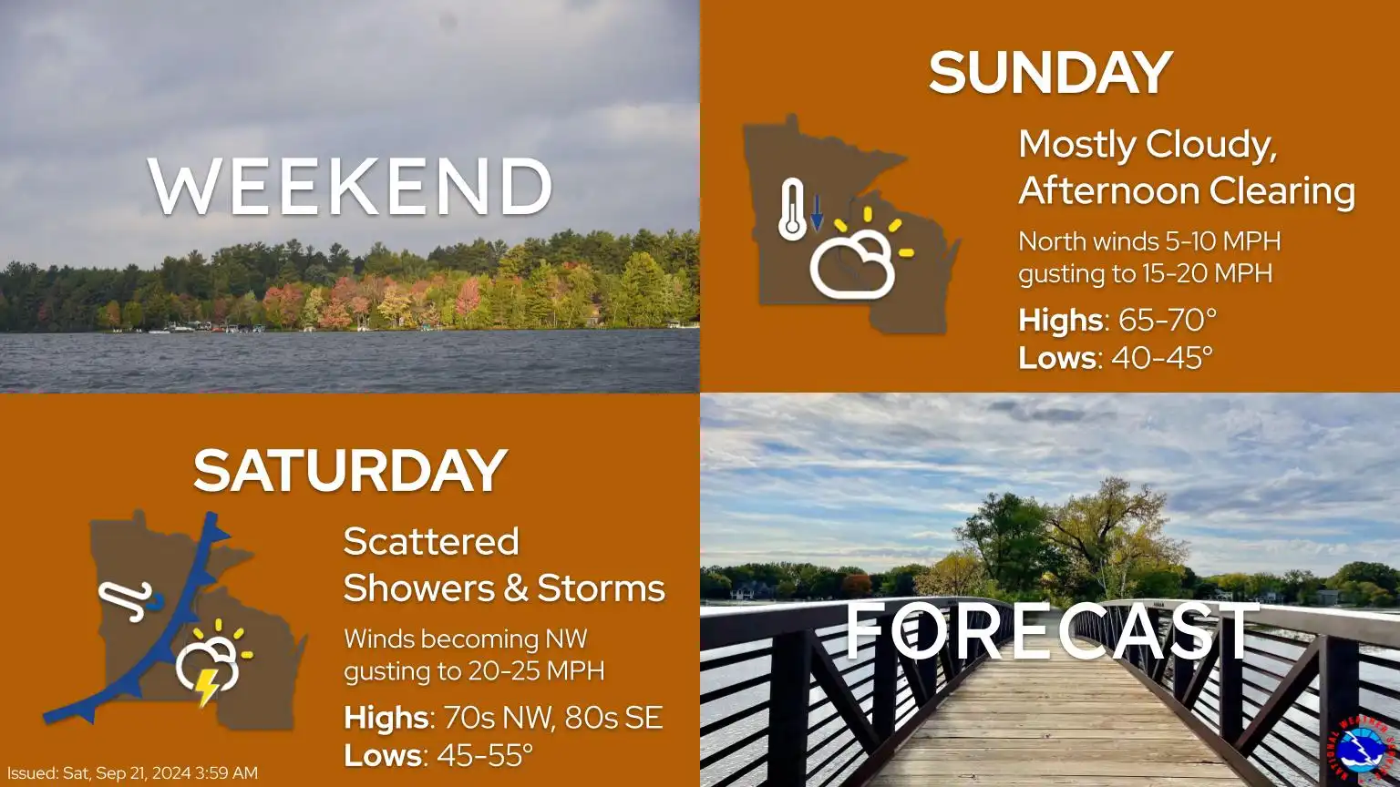
Saturday will begin with showers and thunderstorms, with redevelopment expected in the afternoon and evening. It will be one more warm day in the 80s before a cold front moves in, dropping temperatures into the 60s for Sunday.
Cold front dropping in Saturday
We can expect a return to fall-like temperatures as a cold front moves in from the Dakotas. Low pressure in southern Manitoba will push this cold front into Minnesota, leading to cooler weather on Sunday.
Turn Up Your Support
MPR News helps you turn down the noise and build shared understanding. Turn up your support for this public resource and keep trusted journalism accessible to all.
Temperatures on Saturday will vary significantly across the state, with highs in the lower 80s for the metro and southeastern regions, while northern areas will experience cooler temperatures in the 60s.

Winds will pick up behind the front, with northwesterly winds at 5-15 mph, gusting up to 20 mph. Western Minnesota can expect even stronger gusts.

There will be additional chances for showers and thunderstorms on Saturday afternoon and evening.

These storms have a slight potential to produce larger hail and stronger wind gusts. The Storm Prediction Center has issued a marginal risk for stronger storms in the metro area and southeastern Minnesota.

Sweater weather returns
Sunday will be much cooler following the cold front, with highs across the state in the 60s. For the first time in almost 2 weeks, we will be below our average high of 71.

Fall-like temperatures will persist at the start of the work week, but a warm-up is on the horizon. Temperatures warm back into the mid to upper 70s, Wednesday through Friday.
Next week, a prolonged dry period is expected as high pressure moves in. This will bring plenty of sunshine and eliminate any chances of precipitation. Our metro climate site indicates that we are currently experiencing a 1.93-inch precipitation deficit for September. We’re on track for one of the driest Septembers in state history.