

Temperatures below freezing Sunday night followed by a warmup Monday
Another spring storm approaching midweek

Go Deeper.
Create an account or log in to save stories.
Like this?
Thanks for liking this story! We have added it to a list of your favorite stories.
Temperatures will dip below freezing and below across the state Sunday night, with mostly clear skies. A dramatic warm-up is expected Monday, reaching the mid 60s with increasing southerly winds. Our next storm system will arrive Tuesday into Wednesday, bringing accumulating snow to the region.
A brief system will move across the Northland Sunday night into early Monday morning, bringing light snow accumulation. The heaviest snowfall is expected during the morning commute. A winter weather advisory is in effect from 3 a.m. to noon on Monday.
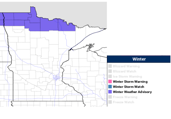
Areas near the border could receive 4-6 inches of snow, with lighter amounts further south.
Turn Up Your Support
MPR News helps you turn down the noise and build shared understanding. Turn up your support for this public resource and keep trusted journalism accessible to all.

We’ll see a quiet start to the work week with warming temperatures into Monday. Sunday night our lows will drop below freezing across the state, cooler teens where the snow will be falling.

Breezy southwesterly winds will begin to pick up slowly Sunday night, gusting up to 30 mph in southern Minnesota on Monday.

Temperatures are forecast to climb 15-20 degrees above the seasonal average for the metro area and points south. Lingering cloud cover and a fresh snow pack will keep northern Minnesota cooler in the 30s.

The temperatures on Tuesday continue to run above average with highs in the 50s and 60s expected, and mid 30s to the northwest.
Our next system is expected to arrive late Tuesday into Wednesday. At this time, areas including the metro and southeast have the potential to receive 4 to 6 inches of accumulating snowfall.
