Record-breaking morning warmth gives way to cool, rainy weather
Cold front brings the return of seasonal temperatures

Go Deeper.
Create an account or log in to save stories.
Like this?
Thanks for liking this story! We have added it to a list of your favorite stories.


An unusually warm start to the day sets the stage for one more mild afternoon before temperatures return to more seasonal levels. Several rounds of rain are also on the way, with the heaviest totals expected across western Minnesota.
Record-warm morning temperatures
Talk about an unusually warm start! Temperatures Saturday morning have been exceptionally mild, with lows only dipping into the upper 50s and lower 60s across the state.

These readings were not only record-warm for the morning, but warmer than typical late-October afternoon highs! Minneapolis–St. Paul broke its record with a low of 60 degrees, surpassing the previous record of 59 set in 2000. International Falls and St. Cloud smashed their previous records of 49 and 53 degrees, respectively, with lows in the low 60s, more than 10 degrees above the old records!
Much of the region will get one more warm afternoon ahead of a cold front that will be moving east from the Dakotas.
Turn Up Your Support
MPR News helps you turn down the noise and build shared understanding. Turn up your support for this public resource and keep trusted journalism accessible to all.
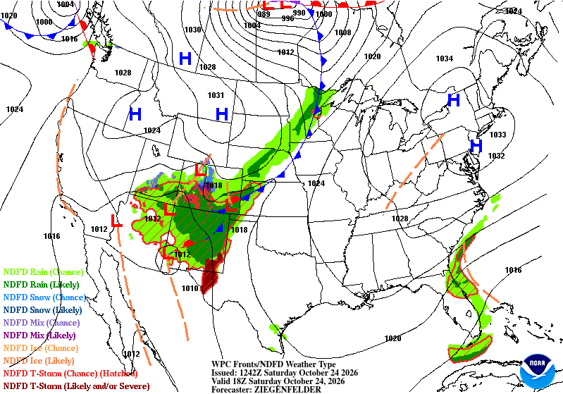
Ahead of the cold front, southerly winds of 10–20 mph will help send the remaining fall leaves flying, making for a breezy end to our stretch of unusually warm weather. High temperatures will climb into the 60s and 70s ahead of the front, while cooler air filtering in behind it will bring temperatures down into the 50s. Once the front passes, winds will shift to the northwest.

Showers will gradually shift eastward through the afternoon and evening. Rainfall totals should be highest across western Minnesota, where isolated amounts between a tenth to a quarter of an inch are possible. Totals will generally decrease farther east, with only a few hundredths of an inch expected in parts of southeastern Minnesota and western Wisconsin.
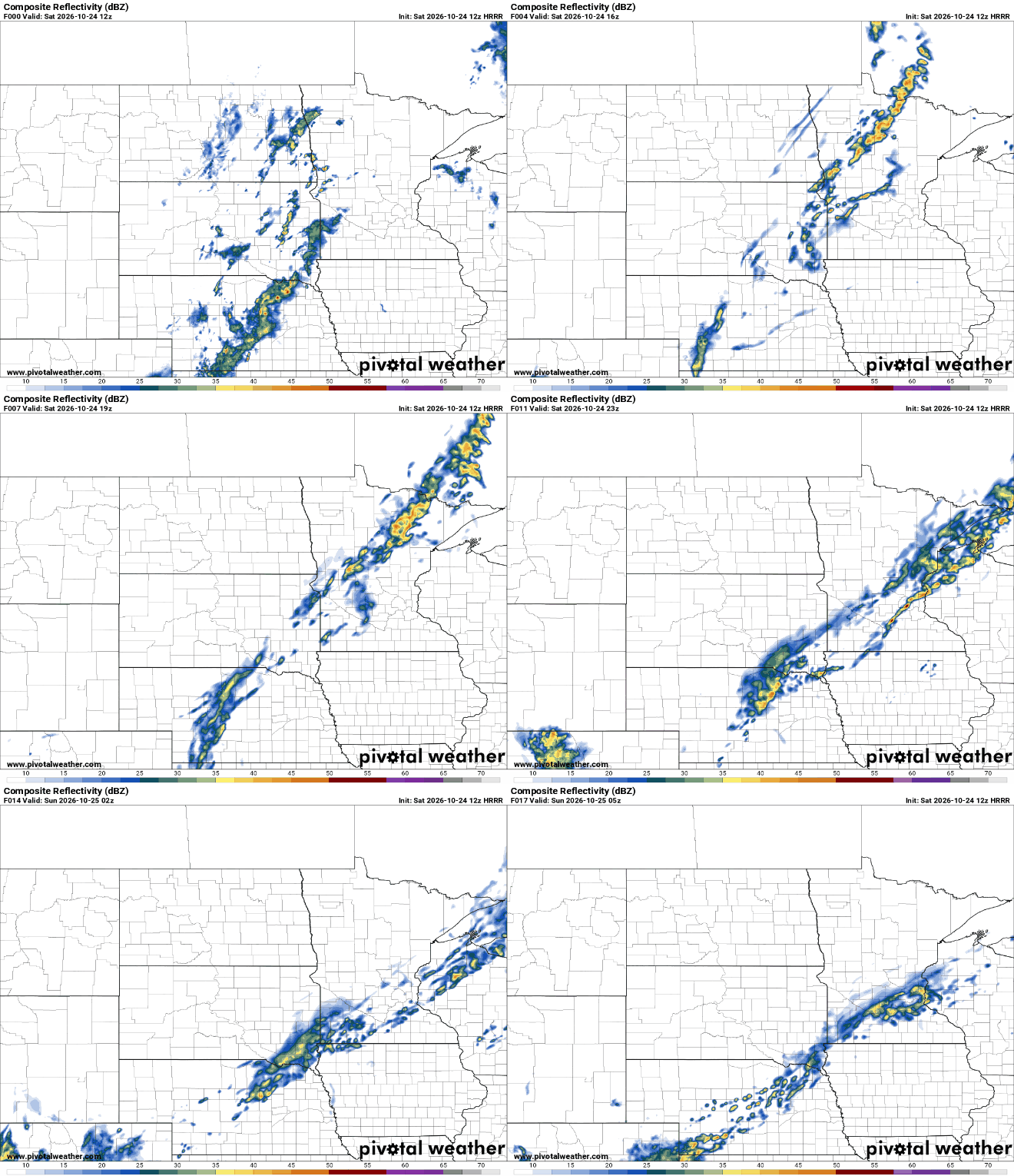
The cooler air moving in behind the cold front will feel like quite a shock after a streak of 70-degree temperatures over the past week. Despite the noticeable chill, Sunday’s temperatures will actually be much closer to what’s typical for late October, with afternoon highs dropping back into the 40s and 50s across the region.

Rain chances ramp up again Monday into Tuesday as another storm system develops over the Plains and tracks north toward Minnesota.
This system has the potential to bring a more widespread and soaking rainfall, especially across western Minnesota. Forecast models suggests that some locations further west could receive 1 to 1.5 inches of rain from this system.

The unsettled pattern looks likely to continue into Wednesday, and with multiple systems expected to affect the Upper Midwest, keep an eye on the forecast as details become clearer over the coming days.