After the snow, communities prepare for heavy flood risk
Go Deeper.
Create an account or log in to save stories.
Like this?
Thanks for liking this story! We have added it to a list of your favorite stories.

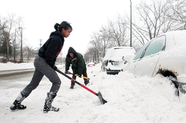
Many Minnesotans haven't finished shoveling out after the weekend storm, but some communities are even more concerned about what happens when the snow melts.
Sunday's accumulation of 11.8 inches at the Twin Cities International Airport was a record snowfall for February 20th. The water content of 0.85 inches was also a record.
According to a recent report from the National Weather Service, the Red, Minnesota and Mississippi river valleys are all at high risk for moderate to major spring flooding. The report says the flood risk is due to heavy autumn rains and above average water content in the snow pack.
The city of Granite Falls sits on either side of the Minnesota River, and Mayor Dave Smiglewski said the latest storm dumped between 14 and 18 inches of high-moisture snow on the area.
Turn Up Your Support
MPR News helps you turn down the noise and build shared understanding. Turn up your support for this public resource and keep trusted journalism accessible to all.
He said the water held in the new snowfall has more than made up for the water they lost in last week's thaw.
"There's just so much water in the ground upstream from us, and a lot of water sitting on top of the ground in the form of snow, un-melted snow upstream from us, that it's definitely going to be an issue for us this spring," Smiglewski said.
Smiglewski said city officials and residents are not waiting until spring to try to hold back the marauding waters of the Minnesota.
"We've done quite a bit of mitigation work in moving houses away from the river, moving some businesses in our downtown away from the river and levy work and flood-wall work," he said. "We're way better prepared than we used to be, but there's still a fair amount to do."
Smiglewski said the city has also ordered more sandbags and is ready to call for volunteer sandbaggers if needed. He said he'd rather not have to deal with rising water every spring, but added that, "It's a fact of life when you live on the river."
DIGGING OUT
Operations were returning to normal at the Minneapolis-St. Paul International Airport after the storm prompted Delta Airlines to cancel hundreds of flights Sunday, although hourlong delays were reported.
Airport spokeswoman Melissa Scovronski said about 60 departures and 100 arrivals were canceled early Monday, but she said she didn't expect more because the weather was clearing.
The National Weather Service reported the storm dropped 12.5 inches of snow at the airport by Monday afternoon.
Roads across the state have improved, but transportation officials say drivers will still find slippery spots.
"Right now we've got scattered slippery spots, I mean you can be going along and have 3-4 miles of dry pavement and then you're going to come up to a spot of what we call blow ice," said Denny Marty, a MnDOT plow supervisor in the Willmar area. "It's where the wind has been sifting the snow across, it melted and now it's just a sheet of ice on the road."
Willmar got about more than a foot of snow.
Road conditions appear to be worse southwest of the Twin Cities near Mankato. A MnDOT spokeswoman in that area said roads are still compacted with snow, causing crashes and spinouts during the morning rush.
MnDOT has rated road travel "difficult" in the middle part of the state -- all the way from the Interstate 90 corridor north to the St. Cloud area.
(The Associated Press and MPR reporter Elizabeth Dunbar contributed to this report).


