

Incredible rainfall totals this week in parts of Minn. and Wis.
Fall color report and a look at our weekend weather
Go Deeper.
Create an account or log in to save stories.
Like this?
Thanks for liking this story! We have added it to a list of your favorite stories.
Friday will be a bad hair day as gusty winds continue. It’ll be chilly too. Fitting weather for Friday the 13th!
How wet has it been?
We tallied 1.17 inches of rain on Thursday at Minneapolis-St. Paul International Airport, which brought our two-day total to 2.41 inches.
This is now the second-wettest year-to-date — Jan. 1 through Sept. 12 — in Twin Cities weather records:
Precipitation includes rainfall plus the water content of snowfalls.
Turn Up Your Support
MPR News helps you turn down the noise and build shared understanding. Turn up your support for this public resource and keep trusted journalism accessible to all.
The heaviest rains over the past week have been from southern Minnesota into southern and central Wisconsin:

The red-shaded areas show anywhere from 5 inches to 8-plus inches of rain, and most of that rain fell from Tuesday night into Thursday night.
There are flood warnings for several areas in southwestern Minnesota and along parts of some rivers in southwestern and south-central Minnesota. The latest flood warning details can be found by clicking on the green-shaded areas on the NWS map.
Rain chances
The northern third of Minnesota plus northwestern Wisconsin will have the best chance of occasional showers this Friday. There could be a passing sprinkle elsewhere in Minnesota and western Wisconsin.
Minnesota and western Wisconsin will have a chance of scattered showers and thunderstorms Saturday afternoon and evening. The National Weather Service Storm Prediction Center shows a marginal risk of severe weather Saturday and Saturday night for portions of Minnesota, including the Twin Cities metro area, and west-central Wisconsin:
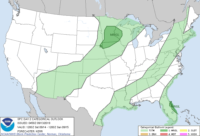
Marginal risk means that an isolated severe thunderstorm is possible. The Storm Prediction Center will update the Saturday severe weather outlook Friday afternoon. Our Sunday looks dry.
As always, updated weather information can be heard on the MPR network, and you’ll also see updated weather info on the MPR News live weather blog.
Temperature trends
Friday afternoon highs are expected to be in the 50s across roughly the northern third of Minnesota, plus northwestern Wisconsin, with 60s elsewhere.
Saturday highs will range from the 60s in the north to lower 80s in parts of southwestern Minnesota:

The Twin Cities metro area could top out in the mid-70s.
Sunday will feature a lot of highs in the 70s, with some 80s in far southern Minnesota:

The metro area could touch 80 on Sunday. Our official Twin Cities high temp hasn’t reached 80 or warmer since Aug. 20.
Twin Cities metro area highs are projected to reach the lower 80s Monday, followed by mid-80s Tuesday and lower 80s Wednesday.
Fall colors
The Minnesota Department of Natural Resources has issued a fall color report that shows spotty color in parts of Minnesota:

A Wisconsin fall color report is also available.
It’s early. Our beautiful fall colors should really start to dazzle in two to three weeks.
Programming note
You can hear my live weather updates on Minnesota Public Radio at 7:49 a.m. Thursdays and Fridays and at 7:35 a.m., 9:35 a.m. and 4:35 p.m. each Saturday and Sunday.
