Why is Minnesota one of the coldest places in a warming earth?
October was the warmest on record globally. But not in Minnesota.

Go Deeper.
Create an account or log in to save stories.
Like this?
Thanks for liking this story! We have added it to a list of your favorite stories.
We know it gets cold in Minnesota. All you have to do is step outside lately.
But an interesting pattern has persisted for the last few years in the Upper Midwest. While most of the earth is recording persistent warmer than average temperatures, Minnesota and the Upper Midwest has been running colder than average.
The blue blob
October was the warmest ever recorded globally according to the European Union’s Climate Change Service.
Turn Up Your Support
MPR News helps you turn down the noise and build shared understanding. Turn up your support for this public resource and keep trusted journalism accessible to all.
Globally, October was 0.69°C warmer than the average October from 1981-2010, making it by a narrow margin the warmest October in this data record.
But an anomalously cold pattern is clearly evident across western and central North America. Minnesota rides the eastern edge of the coldest place on earth relative to the 1981-2010 average. It shows up as a big blue blob across North America.

This analysis from the Midwest Regional Climate Center shows temperatures in most of Minnesota have been roughly 5 degrees colder than average over the past 30 days.

Longer-term trend?
This pattern has caught my eye over the past few years. While much of the globe is trending consistently warm, Minnesota and the Upper Midwest have shown a persistent cold bias. This trend shows up in global temperature patterns over the past 12 months. See the blue shades across central North America?

Record global warm streak
Global surface temperature data shows the past five years are the warmest on record globally; 2018 was the fourth warmest year globally and 2019 is on pace to be the second- or third-warmest year globally.

Why is Minnesota cold?
So, why is Minnesota and the Upper Midwest showing a consistent cool bias in a rapidly warming world? That’s a question I’m not sure we have a clear answer to yet.
But one key may lie in ocean temperatures in the North Pacific. The so-called “blob” is a huge area of unusually warm ocean water in the North Pacific. It emerged in 2014 and has resurfaced again this year.

This massive warm water zone can impact jet stream patterns in the atmosphere above. It may one of the primary reasons Alaska has seen the warmest year on record. And downstream upper-air teleconnections can push cold air intrusions into the Midwest.
Capital Weather Gang’s Ian Livingston elaborates on some of the observed downstream weather pattern impacts from the blob.
This results in a big ridge of high pressure forming over western North America, which brings mild weather and blocks storms.
The blob's presence was linked to the persistence and intensity of the drought in California from 2013 to 2015.
It also ″was blamed for contributing to 2015 being the hottest year on record in Seattle," according to Scott Sistek, a meteorologist with KOMO in Seattle.
As the cold air displaced by the blob has to go somewhere, it then often crashes south in the East. Remember the polar vortex intrusions during the winters of 2013-2014 and 2014-2015? The blob played a role.
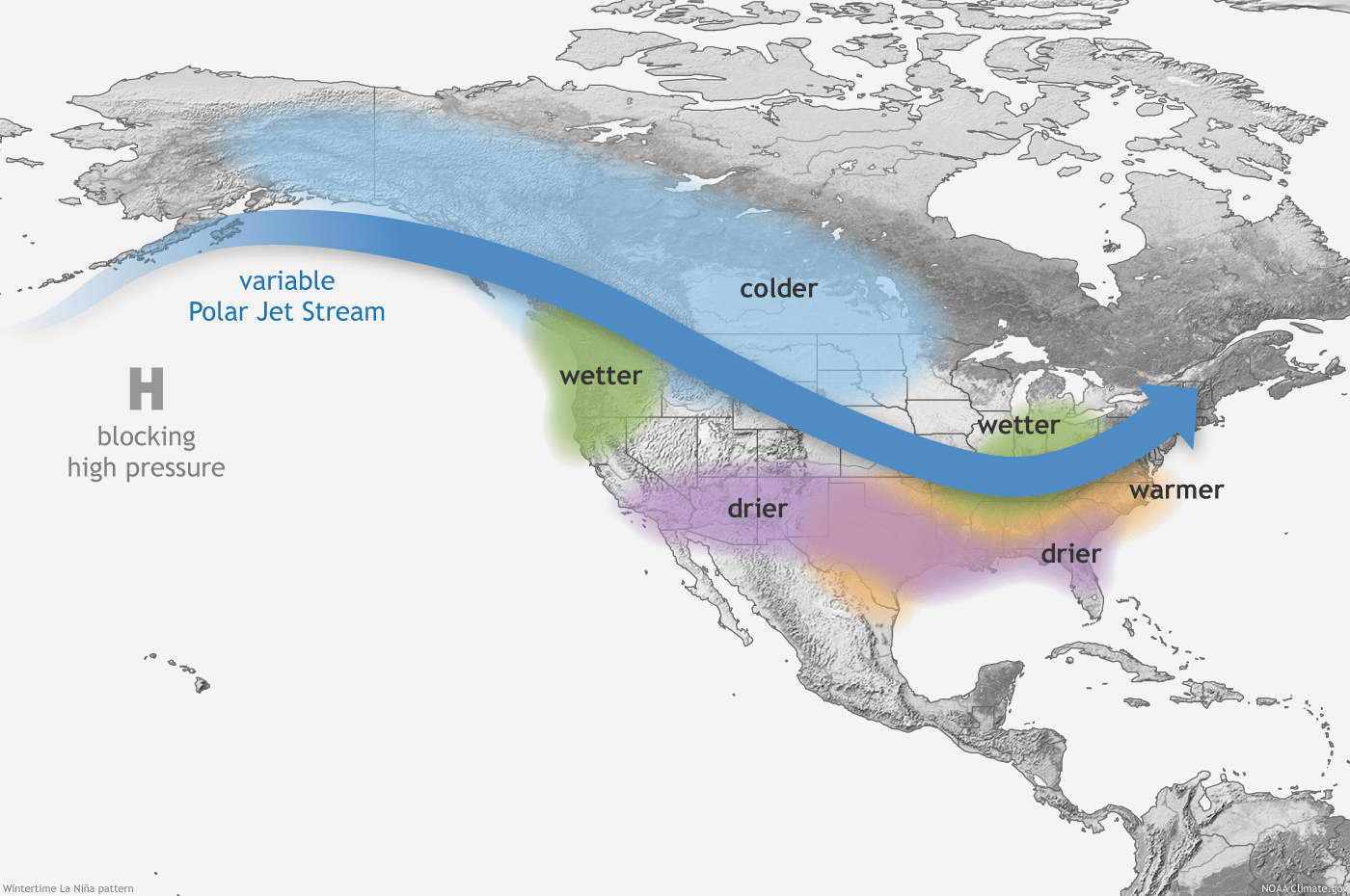
Some meteorologists also point out The blob can shift the jet stream to mimic La Nina jet stream patterns over the lower 48 states. That could be one reason we’re seeing persistent cold air intrusions into Minnesota and the Upper Midwest.

Big picture: Regional variations in a warmer world
The big picture with climate change is that even as the globe as a whole gets measurably warmer, there are still regional variations. The last few years seem to suggest that one of those colder regions has set up across the middle of North America.
Scientists are still learning about how the regional impacts of a rapidly warming planet are playing out.


