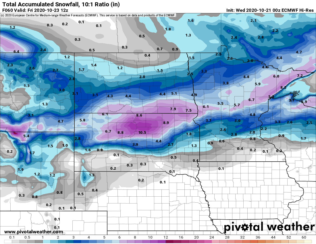
Next winter storm targets central Minnesota Thursday
Snowfall totals could reach 5 to 9 inches in parts of central Minnesota.

Go Deeper.
Create an account or log in to save stories.
Like this?
Thanks for liking this story! We have added it to a list of your favorite stories.
Lather, rinse, repeat.
An active jet stream over Minnesota is dealing wintry storms our way every two to three days this week. Our next wintry-weather-maker arrives Thursday. This one focuses on central Minnesota.
This time the favored winter storm zone lays out across central and northeast Minnesota north and west of the Twin Cities.

The latest model runs from midday Wednesday suggest the snow zone may shift a little more south than the graphic above. That could mean some minor accumulations favoring the northern half of the Twin Cities. But the bulk of the heaviest snow zone lays out across central Minnesota.
The European model cranks out a swath of between 5 and 9 inches across central and northeast Minnesota Thursday. It should be noted that some forecast models suggest higher snowfall totals to 10 inches or more are possible in this zone.

NOAA’s GFS model favors a wintry mix for the Twin Cities Thursday that could include snow, sleet, ice and rain.

Stay tuned as we tweak forecasts through tonight.
Turn Up Your Support
MPR News helps you turn down the noise and build shared understanding. Turn up your support for this public resource and keep trusted journalism accessible to all.


