

Northern lights possible Wednesday night across Minnesota
Warm weather gives way to seasonable cold by the weekend
Go Deeper.
Create an account or log in to save stories.
Like this?
Thanks for liking this story! We have added it to a list of your favorite stories.
Mostly clear skies not only help temperatures soar Wednesday but also allow for viewing of a possible northern lights show into Thursday morning.
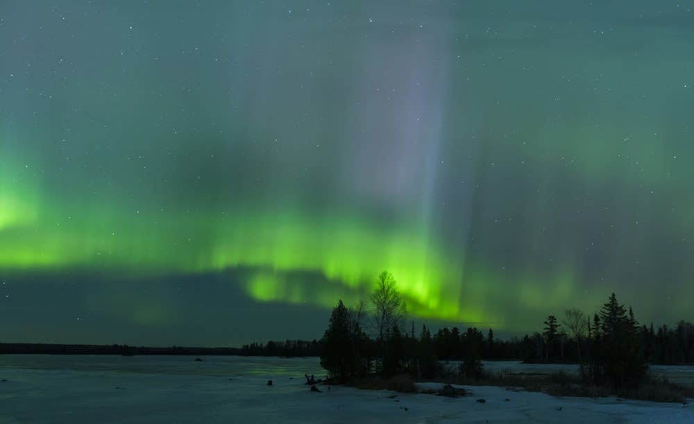
Northern lights potential
After a few quieter years, solar physicists are forecasting a more active cycle in solar activity and solar storms in coming years. While those storms can cause impacts to things like electronic communications, they also allow for some incredible northern light shows.
On Monday, scientists observed a solar flare erupt in an area directly facing Earth, with a “coronal mass ejection” headed toward our planet.
Because of this, a geomagnetic storm watch is in effect from Wednesday through Friday, with a Level 3 storm (on a scale of 5, 3 is considered “strong”) possible on Thursday.
Turn Up Your Support
MPR News helps you turn down the noise and build shared understanding. Turn up your support for this public resource and keep trusted journalism accessible to all.

This could make the aurora borealis visible through the entire state late Wednesday night into early Thursday morning, and it may end up being the strongest solar storm of 2020.
Given forecast cloud-cover for the same time-frame, southern Minnesota has the best chance of seeing the northern lights should they occur.

Wednesday and Thursday forecast
Wednesday started off very mild, with lows varying from the 20s north to 30s south. Given that high temperatures this time of year mostly range from the low to upper 20s across the state, that put most of the lows Wednesday morning warmer than typical December highs.
Thanks to plentiful sunshine, most of the state makes it into the 40s by Wednesday afternoon, with a few 50s southwest.

This places temperatures 15 to 25 degrees above average and makes it the warmest day of the week for much of the state. Western Minnesota has already been warmer much of the week, under more sunshine, so this continues the mild trend there.
Skies stay predominantly dry and sunny Wednesday, except for the northern edge of the state, where a disturbance moves light snow across the area from late Wednesday into Thursday morning. Most places can expect under 2 inches of snow.

This also brings more clouds across the state again, with northern Minnesota mostly cloudy by Wednesday night and southern Minnesota seeing more of the clouds return Thursday afternoon.
The extra cloud cover drops highs a few degrees from Wednesday, but it will still be above average in the 30s and 40s.
Extended forecast
Northerly winds return Friday, dropping temperatures to more seasonable levels through the start of next week. Highs will be generally in the 20s north and 30s in southern Minnesota.
Here is that forecast for the Twin Cities:

Meanwhile, a potent storm passes southeast of the state Friday into Saturday, but it currently looks like the precipitation will only clip southeastern Minnesota.

It does contribute to more clouds Friday and Saturday, with the sunniest day of the weekend currently forecast to be Sunday.
Programming note
You can hear my live weather updates on Minnesota Public Radio at 7:48 a.m. Monday through Friday morning.
