

Severe risk: Midnight thunder Monday?
Heat index pushing 100 Tuesday and Wednesday

Go Deeper.
Create an account or log in to save stories.
Like this?
Thanks for liking this story! We have added it to a list of your favorite stories.
Our nocturnal thunderstorms season is cranking up.
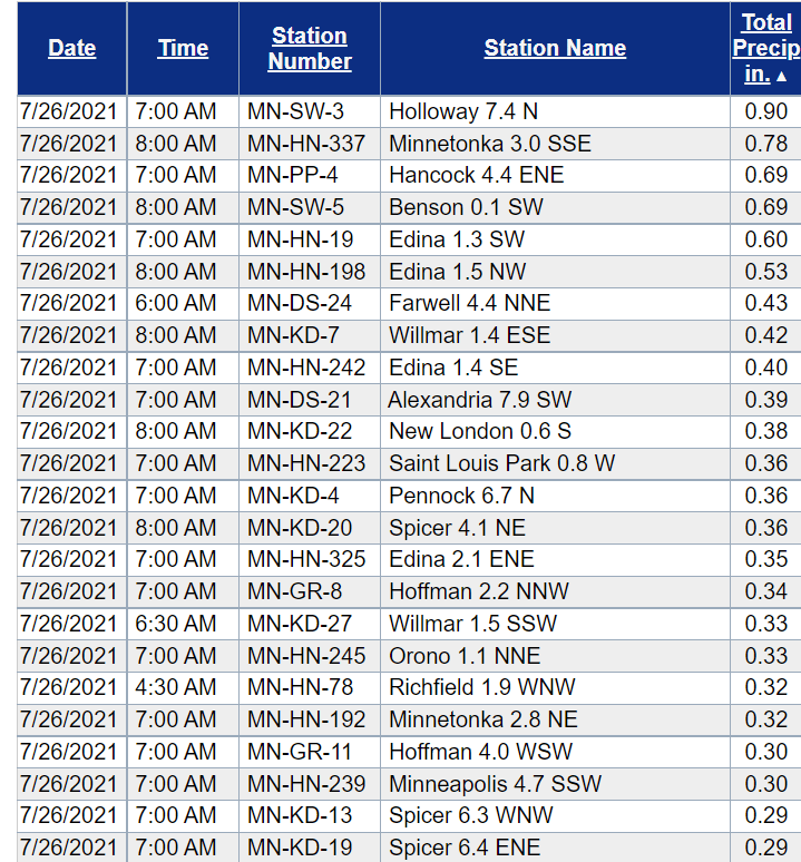
A cluster of rain and thunderstorms delivered some meaningful rainfall from western Minnesota into parts of the Twin Cities. Some 1 inch rainfall totals fell across western Minnesota, with half an inch in parts of the western Twin Cities.
Here are some select rainfall totals from the overnight storms.
Benson 1.55 inches
Holloway 0.9 inches
Minnetonka 0.78 inches
Edina 0.6 inches
Willmar 0.42 inches
Severe risk Monday night
There is an enhanced risk for severe storms through tonight across much of northern and central Minnesota. This includes Brainerd, Grand Rapids, Duluth and Hinckley.
Turn Up Your Support
MPR News helps you turn down the noise and build shared understanding. Turn up your support for this public resource and keep trusted journalism accessible to all.
A slight risk surrounds that area and includes the Arrowhead from Ely to the North Shore and the I-94 corridor from Fargo through St. Cloud.
A marginal risk includes the Twin Cities.
Storm coverage and timing?
Forecast models suggest scattered storms will develop across central and northern Minnesota through Monday evening. The storms will likely drift slowly southward overnight Monday. The European model brings storms close to the Twin Cities by midnight.
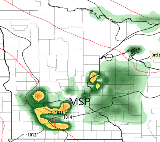
NOAA’s NAM 3 km resolution model favors storms around 2 or 3 a.m. for Twin Cities.

Excessive heat watch
Another shot of intensely hot and humid air blows across southern Minnesota Tuesday and Wednesday.
The Twin Cities NWS has posted an excessive heat watch for Tuesday and Wednesday.
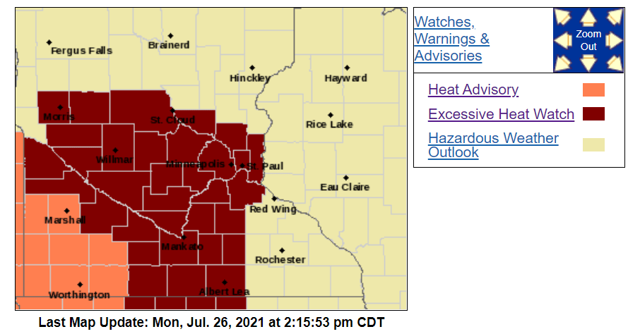
Heat index values will likely exceed 100 degrees across most of southern Minnesota Tuesday and Wednesday.

Thankfully, a cooler and much less humid air mass arrives Thursday into the upcoming weekend.

