Updated severe potential Wednesday; highest risk zone in Wisconsin
Severe storms are likely in eastern Minnesota and especially Wisconsin.
Go Deeper.
Create an account or log in to save stories.
Like this?
Thanks for liking this story! We have added it to a list of your favorite stories.
We’re still watching the severe weather pot to see where it boils today.
A low-pressure system and cold front is sagging southeast across our region today. That’s triggering some strong storms, and the severe risk is there. The highest risk for severe storms and possible tornadoes lies across Wisconsin today. But eastern Minnesota is also in the risk zone.
The National Oceanic and Atmospheric Administration’s Storm Prediction Center’s midday update paints a moderate risk across much of Wisconsin. The highest risk zone has shifted slightly eastward today. A slight risk covers most of the Twin Cities and eastern Minnesota.

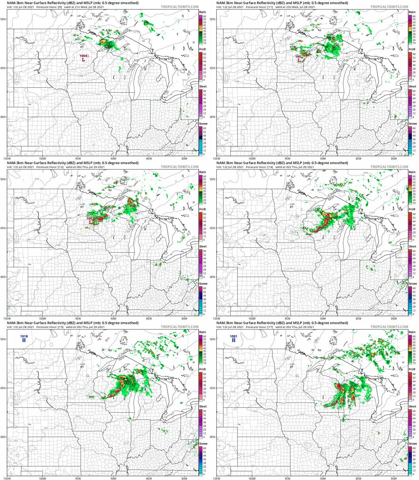
NOAA’s NAM 3 km resolution model spawns a line of potentially damaging storms with possible tornadoes this afternoon across Wisconsin moving southeast. The western edge may just clip the Twin Cities according to many forecast solutions.

Some models keep the bulk of the severe storms east of the Twin Cities, but it looks like a close call.
Stay alert for likely severe weather watches and warnings later this afternoon and evening.
Turn Up Your Support
MPR News helps you turn down the noise and build shared understanding. Turn up your support for this public resource and keep trusted journalism accessible to all.


