5-10 inches of snow possible through Monday as clippers sweep Minnesota
Much of Minnesota could see 6 inches of snow by Monday night

Go Deeper.
Create an account or log in to save stories.
Like this?
Thanks for liking this story! We have added it to a list of your favorite stories.
Get ready for a few shots of light to moderate snow, Minnesota. A family of clippers sails southeast across the Upper Midwest through Monday.
Let’s break down the snowfall timing and likely totals through Monday.
System 1, Friday night
As our temperatures moderate Friday, a low pressure through trailing from a low in Canada will sweep across Minnesota Friday night. A band of snow moves into the Red River Valley Friday afternoon and pushes southeast across Minnesota through Friday night.
Snowfall likely reaches the Twin Cities between about 6 and 8 p.m. Friday on most forecast models. Here’s the National Oceanic and Atmospheric Administration’s North American Mesoscale Forecast System 3 km model loop between noon Friday and midnight Saturday:
Turn Up Your Support
MPR News helps you turn down the noise and build shared understanding. Turn up your support for this public resource and keep trusted journalism accessible to all.

Overall snowfall totals with Friday’s night’s system likely range from 1 to 3 inches across Minnesota, with the heaviest totals favoring the northern half of our state. Here’s the Canadian model snowfall output.

System 2, Saturday night
A second clipper rides across Minnesota Saturday night. This one also looks likely to bring a zone of 1 to 3 inches across much of central and southern Minnesota.

System 3, Monday
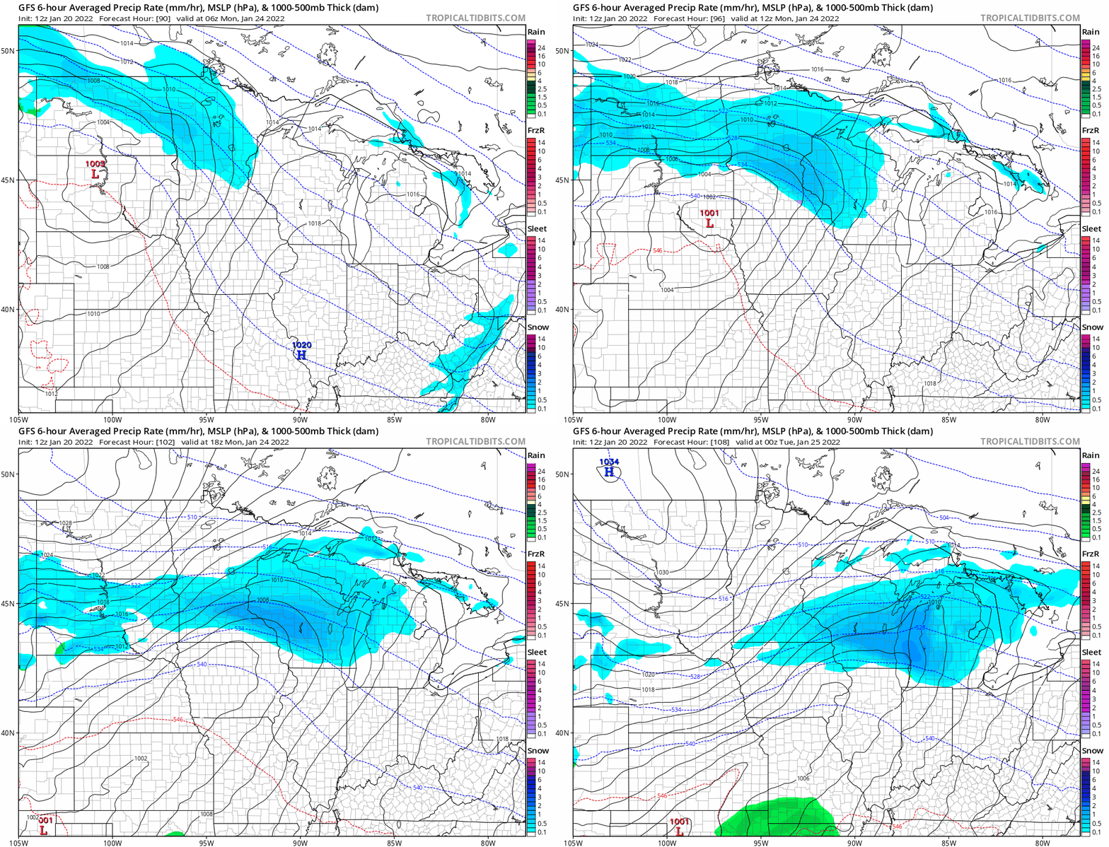
The strongest of the three weather systems likely arrives late Sunday night through Monday. This clipper looks more potent, and appears capable of delivering heavier snowfall totals.
Snow likely begins late Sunday night, and continues across parts of central and southern Minnesota through Monday. This system looks likely to mess with both rush hours Monday.
Here’s NOAA’s Global Forecast System model Monday.

It’s still early and the storm track could change, but Monday’s clipper appears capable of delivering a 3- to 6-inch snowfall across parts of central and southern Minnesota.
6 to 10 inches total by Monday night?
We’ll have to see how each of the three systems tracks, but forecast models are cranking out significant snowfall between the three systems through Monday.
The Canadian model is on the conservative side and suggests most of central and southern Minnesota will add around another 6 inches of snow through Monday.

NOAA’s GFS model is more aggressive, and cranks out more than 10 inches of snow for parts of eastern Minnesota potentially including the Twin Cities, with more than a foot in western Wisconsin.

Peak snow depth ahead
We’re entering the season of typical peak snow depth in Minnesota over the next few weeks. Right now there is already plenty of snow to play in across central and northern Minnesota.
Here are some select snow depth readings reported across Minnesota as of Thursday.
Minneapolis-St. Paul International Airport, 5 inches
St. Cloud, 7 inches
Duluth, 12 inches
Brainerd area to Leech Lake, 14-16 inches
International Falls, 16 inches
Chisholm, 20 inches
Tofte, 22 inches
Wolf Ridge, Finland, 26 inches
Here’s the current snow cover map across Minnesota.

The next four weeks look like peak snow cover across Minnesota.
Growing snow depth could potentially be good news for adding springtime runoff to lakes and rivers across Minnesota. This is shaping up to be a good winter across our region for recreation that relies on snowfall.
Get out there, Minnesota!
Dear reader,
The trustworthy and factual news you find here at MPR News relies on the generosity of readers like you.
Your donation ensures that our journalism remains available to all, connecting communities and facilitating better conversations for everyone.
Will you make a gift today to help keep this trusted new source accessible to all?


