Mixed weather bag: Rain, snow showers, and some sun this weekend.
Lake Superior ice cover running near seasonal average for early April.

Go Deeper.
Create an account or log in to save stories.
Like this?
Thanks for liking this story! We have added it to a list of your favorite stories.
If you don’t like the weather, just wait 15 minutes. Or more like 15 hours this weekend.
Two minor weather systems passing through Minnesota this weekend will be strong enough to bring a mix of rain and snow showers. In between, sunnier skies will grace much of southern Minnesota Saturday afternoon.
The first system rolls through Friday night into early Saturday. A mix of light rain and snow showers covers most of central and southern Minnesota. The bulk of the system with more concentrated precipitation coverage rolls through Iowa.

Saturday starts cloudy, but sunshine should return to most of southern and western Minnesota during Saturday afternoon. Here’s NOAA’s NAM 3 km model low cloud coverage forecast for 3 pm Saturday.
Turn Up Your Support
MPR News helps you turn down the noise and build shared understanding. Turn up your support for this public resource and keep trusted journalism accessible to all.

Highs should approach 50 degrees in the Twin Cities and southern Minnesota alter Saturday afternoon.

So Saturday afternoon through sunset looks like the best time of the weekend to get out and enjoy some decent early spring weather.
Sunday brings another weather system to Minnesota. It looks like another mix of rain and snow showers. NOAA’s NAM 3 km resolution model paints bands of rain and snow showers across much of Minnesota Sunday afternoon and evening. The loop below runs between 1 pm Sunday and 1 am Monday.

There could be a light coating of snow again in many areas by Monday morning.
I know…
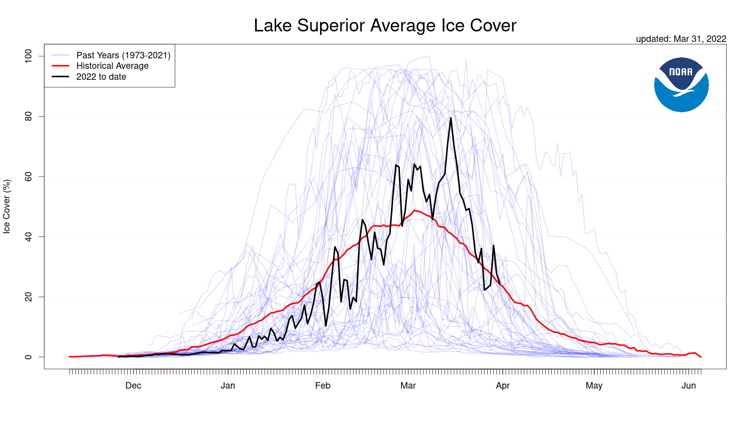
Great Lakes ice cover near seasonal average
Lake Superior is showing plenty of open water as we move into early April. Most of the ice is packed near-shore.

Lake Superior Ice cover is currently running close to seasonal averages for April 1st at around 20%.

Ice cover usually declines rapidly through the month of April to less than 5% by May 1.


