Scattered storms with a higher severe threat Thursday
Enhanced severe weather risk on Thursday across SE Minnesota

Go Deeper.
Create an account or log in to save stories.
Like this?
Thanks for liking this story! We have added it to a list of your favorite stories.
Wednesday brought a line of severe thunderstorms to parts of northern and central Minnesota. The line packed hail, high winds and heavy downpours.
Here are some select preliminary storm reports from Wednesday afternoon.
8 SSW Blackberry [Itasca Co, MN] PUBLIC reports TSTM WND DMG at 2:45 PM CDT -- CORRECTS PREVIOUS TSTM WND DMG REPORT FROM 8 SSW BLACKBERRY. BROKEN LARGE TREE BRANCH, A TABLE UMBRELLA LOOKS LIKE IT EITHER FELL ON OR THROUGH THE TABLE.
Chisholm [St. Louis Co, MN] PUBLIC reports LIGHTNING at 3:20 PM CDT -- PICTURE OF HOUSE CHIMNEY DESTROYED BY LIGHTNING STRIKE RELAYED VIA SOCIAL MEDIA. TIME ESTIMATED BY RADAR.
6 SW Lawler [Aitkin Co, MN] PUBLIC reports TSTM WND DMG at 3:50 PM CDT -- A FEW ROOF SINGLES BLOWN OFF A HOME.
Twig [St. Louis Co, MN] PUBLIC reports TSTM WND DMG at 4:06 PM CDT -- TREES UPROOTED. POWER OUTAGES.
1 ESE Mcgregor [Aitkin Co, MN] PUBLIC reports FUNNEL CLOUD at 3:31 PM CDT -- REPORTER DESCRIBED LOWERING AND SPINNING OF CLOUDS UNDER CELL NEAR MCGREGOR.
Enhanced risk Thursday
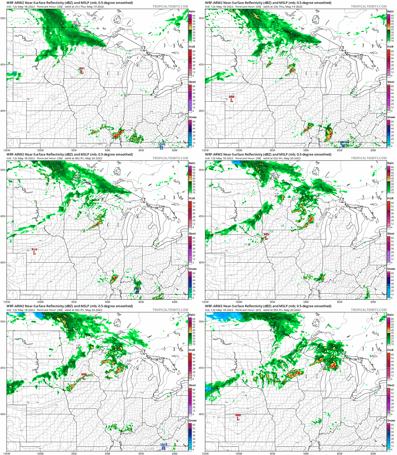
Thursday brings another favorable environment for scattered strong to severe storms.
The National Oceanic and Atmospheric Administration’s Storm Prediction Center paints an enhanced (level 3 of 5) risk zone across southeast Minnesota. The Twin Cities is included in the slight risk (level 2 of 5) zone.

NOAA’s Weather Research and Forecasting model suggests a cluster of storms forming late Thursday afternoon near or south of the Twin Cities. Additional storms may fire through the evening hours. The loop below runs between 4 p.m. Thursday and midnight Friday.

Stay tuned for possible severe weather watches and warnings Thursday afternoon and evening.
Turn Up Your Support
MPR News helps you turn down the noise and build shared understanding. Turn up your support for this public resource and keep trusted journalism accessible to all.
Dear reader,
Political debates with family or friends can get heated. But what if there was a way to handle them better?
You can learn how to have civil political conversations with our new e-book!
Download our free e-book, Talking Sense: Have Hard Political Conversations, Better, and learn how to talk without the tension.


