

Patchy, wintry mix in northern Minnesota; Thanksgiving morning fog
Overall weekend travel looks good; some icy spots possible up north Thursday morning

Go Deeper.
Create an account or log in to save stories.
Like this?
Thanks for liking this story! We have added it to a list of your favorite stories.
Happy Thanksgiving from the Weather Lab!
We love to talk about all the fascinating weather phenomena every week. I hope you caught my post earlier Wednesday on Northern Hemisphere snow cover.
This is one of those evenings when people who travel for the holiday need basic nuts-and-bolts weather information. Just the weather facts. So here you go.
Patchy, light wintry mix in northern Minnesota
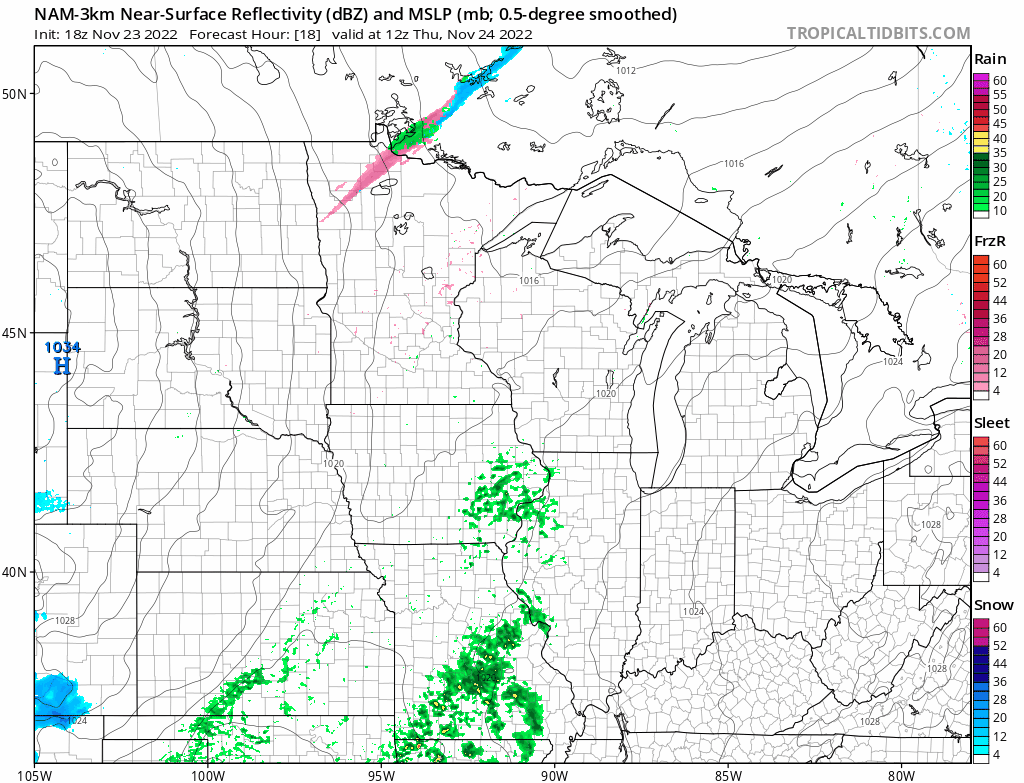
A minor weather system with patchy light snow and freezing drizzle will cross northern Minnesota overnight into Thanksgiving morning. The Grand Forks, N.D., National Weather Service office highlights the zone of wintry precipitation for northwestern Minnesota overnight into Thursday.
Turn Up Your Support
MPR News helps you turn down the noise and build shared understanding. Turn up your support for this public resource and keep trusted journalism accessible to all.
The National Oceanic and Atmospheric Administration’s North American Mesoscale Forecast System model picks up a ribbon of mixed precip across northern Minnesota into northwestern Wisconsin between 6 a.m. and 3 p.m. Thursday.
Patchy fog
We hit a balmy 47 degrees in the Twin Cities Wednesday afternoon. That’s 9 degrees warmer than average.
So far, November is running about 1 degree colder than average.
As temperatures fall to near the dew point Wednesday night, expect fog and low stratus to form across much of Minnesota. NOAA’s NAM 3 km model shows the trend between 3 p.m. Wednesday and 9 a.m. Thursday.

Visibility could be down to around or less than one-quarter mile early Thanksgiving Day.
Milder weekend ahead
A return to sunshine and milder temperatures resumes for Black Friday. Highs should push the 40-degree mark once again in southern Minnesota Friday afternoon.
Saturday looks sunny, breezy, and milder. Highs will reach the 40s across most of southern Minnesota, and I won’t be shocked to see a 50-degree temperature close to the Twin Cities Saturday afternoon.

Sunday looks windy and colder once again as temperatures fall through the 20s north and 30s south.
Safe travels, everybody.
