Snow showers slowly wind down; brutal cold next week
Additional light snowfall accumulations through early Saturday

Go Deeper.
Create an account or log in to save stories.
Like this?
Thanks for liking this story! We have added it to a list of your favorite stories.
Snow showers continue on and off Friday into Friday night as our multiday storm slowly moves east. Friday will still be relatively mild but temperatures will be cooling down through the weekend.
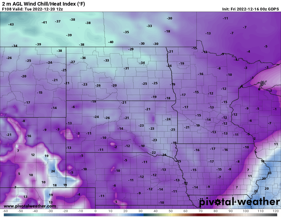
Next week brings subzero temperatures and wind chills.
Latest snow totals, moisture in this storm
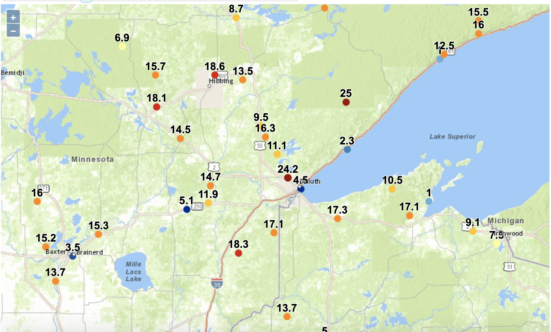
The snow continues to add up in many places. North Shore snow totals are all between 2 and 3 feet and many places could see an additional 2 to 4 inches through early Saturday. Duluth saw it’s eighth largest snowstorm on record for a 48-hour period.


The moisture content for this long-duration storm system has been notably high. At Minneapolis-St. Paul International Airport, we’ve received 1.11 inches of water equivalent precipitation since Tuesday, making this the biggest precipitation event since late August.
Turn Up Your Support
MPR News helps you turn down the noise and build shared understanding. Turn up your support for this public resource and keep trusted journalism accessible to all.

Scattered snow showers into early Saturday
We’ll continue to see snow showers rotate around the low, which is slowly tracking east Friday into early Saturday.

Additional snowfall amounts will generally be light around 1 inch, but there will be a few pockets of 2-inch amounts and still 2 to 4 more inches along the North Shore.

Much colder next week; a few snow chances
Temperatures will drop through the weekend with the coldest readings coming by the early to middle part of next week. We also have another possibility of snow on Monday.

Monday night will be pretty cold, subzero statewide and for the first time this season in the Twin Cities.

The wind chill will range from minus 15 to minus 30 across Minnesota Tuesday as well.

We’re keeping our eyes on another storm system next Wednesday into Thursday which could bring more snow to Minnesota or head just south.

Dear reader,
The trustworthy and factual news you find here at MPR News relies on the generosity of readers like you.
Your donation ensures that our journalism remains available to all, connecting communities and facilitating better conversations for everyone.
Will you make a gift today to help keep this trusted new source accessible to all?


